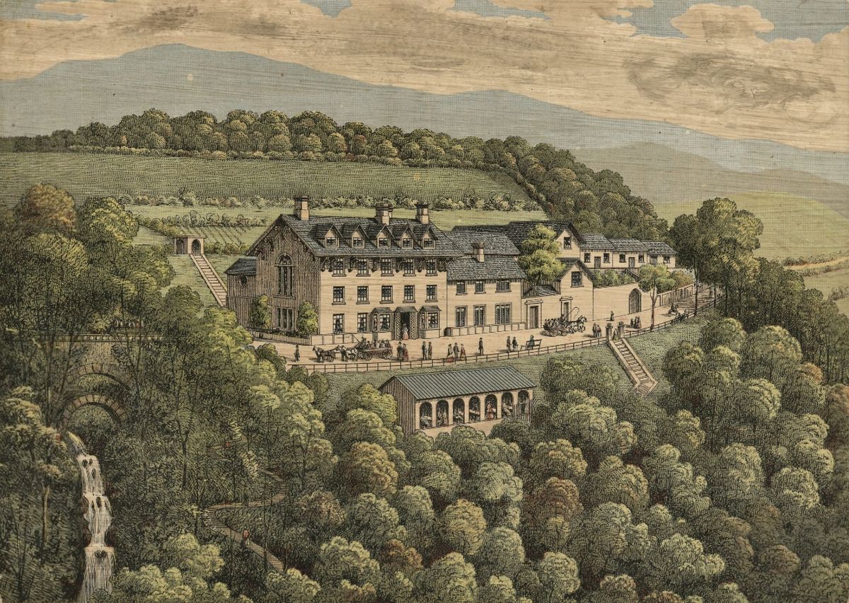
8th July 1819, Waterfalls: Rhaeadr Du, Rhaeadr Mawddach, Pistyll Cain

Thursday 8th July 1819

 
LUCY 56b.jpg
 
LUCY 57a.jpg

Thursday July 8th We had intended passing this day in surveying three very beautiful Waterfalls seven miles from Dolgilly the ride to them is very beautiful the first called Rhaiader Dolmelynllyn (an easy Welsh name) is 60 feet long and continues rising through


a bed of rocks for half a mile, the second called Rhaeadr Mawddach falls down a rock of 60 feet; and Pistill Cain considered the finest rushes down a rock of 150 feet high in my opinion they all surpass the Devils Bridge and are most romantically situated we arrived at the Inn very late.


OBSERVATIONS & COMMENTS:

Waterfalls became places of tourism and recreation in eighteenth-century Wales and by the heyday of the Celtic Tour at the end of the eighteenth century and the beginning of the nineteenth they had achieved a special status as one of the iconic features of the Welsh landscape. There was a developing interest in natural scenery in Wales earlier in the eighteenth century, and waterfall scenery was incorporated into private parks. Waterfalls were sought out by travellers through North and South Wales, the consequence of which was that the waterfall became one of the chief aesthetic thrills of the period. Interest waned in the nineteenth century when waterfalls could no longer be relished as undiscovered and tourists were drawn further afield. Aesthetic attitudes also changed. The waterfall was no longer part of a social scene, nor was it viewed as a part of a harmonious landscape that contrasted rural with urban life. The waterfall became a work of nature in its own right. https://www.tandfonline.com/doi/full/10.1179/1466203513Z.00000000017?scroll=top&needAccess=true

Rhaiader Dolmelynllyn: We were unable to identify any falls called Rhaeadr Dolmelynllyn but Lucy would have been referring to Rhaeadr Du, an impressive set of falls that have a total drop of over sixty feet and take their name from the slab of black rock over which the water of Afon Gamlan cascades. Lucy writes that Rhaeadr Dolmelynllyn is 60 feet long , the length quoted in Snowdonia Guide for Rhaeadr Du. Our reader, Roger Hird, has kindly confirmed this and writes: "Rhaeadr Dolmelynllyn" is clearly the waterfall now called Rhaedr Ddu, in Ganllwyd. Dolmelynllyn is the name of the old house which was rebuilt in the 19th century and is now a hotel - about a quarter of a mile to the south of the falls. The falls are on the estate originally associated with the house.

The house, by the way, is in some way linked to William Maddocks the London lawyer (with Welsh connections) who built the village of Tremadoc and the the town of Portmadoc (now Tremadog and Porthmadog) - and who drained the estuary of Afon Glaslyn, the Traeth Mawr. He had bought a house above the traeth, Tan-yr-Allt but I remember suggestions that he had stayed at or perhaps borrowed the Dolmelynllyn house. I haven't tracked down the source of this.

The Afon Gamlan is a short river which flows through the Cwm Camlan Valley into the Mawddach at Ganllwyd north of Dolgellau. http://www.snowdoniaguide.com/rhaeadr_du.htm and https://www.nationaltrust.org.uk/trails/-rhaeadr-ddu-and-coed-ganllwyd-walk

Rhaeadr Mawddach: Rhaeadr Mawddach is a small waterfall in the river Afon Mawddach located in the Coed y Brenin forest (Snowdonia), which means forest of the kings. It is a mighty waterfall (after rainfall) that drops down over 35 meters in three jumps. Although the waterfall isn’t as high as Pistyll Cain , the volume is much bigger. Pistyll Cain is located near the Rhaeadr Mawddach in the river that runs to the west, Afon Gain. Pistyll is Welsh word for waterfall. http://www.europeanwaterfalls.com/waterfalls/rhaeadr-mawddach/

Just below the fall are the remains of the Gwynfynydd Goldmine. The English Royal family traditionally have wedding rings made from Welsh gold.

Pistyll Cain is a waterfall with height of 20 meter in the river Afon Gain located in the Coed y Brenin forest (Snowdonia), which means forest of the kings. Here the river Afon Gain tumbles down over a rock cliff in a gorgeous surrounding. http://www.europeanwaterfalls.com/waterfalls/pistyll-cain/

1813 - Fall of the Cayne, north Wales,engraved by M S Barenger from the collection of the National Library of Wales Accession number 1130569 made available under the Creative Commons CC0 1.0 Universal Public Domain Dedication. https://commons.wikime…

1813 - Fall of the Cayne, north Wales,engraved by M S Barenger from the collection of the National Library of Wales Accession number 1130569 made available under the Creative Commons CC0 1.0 Universal Public Domain Dedication. https://commons.wikimedia.org/wiki/File:Fall_of_the_Cayne,_north_Wales_(1130569).jpg

2009: Pistyll Cain Waterfall, author Keith Ruffles, Source https://www.panoramio.com/photo/27339483 licensed under the Creative Commons Attribution 3.0 Unported license. From https://commons.wikimedia.org/wiki/File:Pistyll_Cain_Waterfall_-_panoramio…

2009: Pistyll Cain Waterfall, author Keith Ruffles, Source https://www.panoramio.com/photo/27339483 licensed under the Creative Commons Attribution 3.0 Unported license. From https://commons.wikimedia.org/wiki/File:Pistyll_Cain_Waterfall_-_panoramio_(1).jpg

A YouTube video of Pistyll Cain by Stewart Jones, Published on 6 Jun 2017, can be sourced here
PISTYLL CAIN WATERFALL @ COED Y BRENIN


The print, above was published in 1813, not long before Lucy’s visit. It differs little from the photograph of 2009

Can you help us?

Old Regency Prints, Pictures an Coaching maps: Do you have access to any prints or pictures showing what town and country would have looked like when Lucy travelled through? Any illustrations of what she would have seen in 1819 will enliven our research.

New Pictures: Do you have any modern pictures of the streets, buildings, gardens and views that would enable us to see the changes that two centuries have wrought?

Corrections and advice are welcomed

7th July 1819, Dolgellau, Summit Cader Idris

Wednesday 7th July 1819

 
LUCY 54.jpg
 
LUCY 55.jpg
 
LUCY 56a.jpg
 

Wednesday July 7th After breakfast we commenced (mounted our Welsh Ponies, & our own ponies) the arduous undertaking of gaining the summit of Cader Idris the ascent for two miles is very easy but afterwards it becomes very steep and the path which is covered with large stones obliged us to leave our own horses and ride alternatively on the ponies in this

manner we continued almost *** in the *** for several hours when with great difficulty we arrived at the summit. The huge mountains which we before looked up to with astonishment were now far below our feet the view is certainly very grand and extensive but I cannot say I think it recompensed us for the trouble and fatigue we experienced in attaining it we took some refreshment and commenced descending an undertaking if possible

more tedious and difficult than we had just performed at ½ past eight we found ourselves comfortably seated to dinner and happy we were let me assure the reader to find ourselves there after dinner we soon retired to rest.


OBSERVATIONS & COMMENTS:

Ponies: The Coplands rode “our Welsh ponies and our own ponies”. Whilst they may have taken their own horses with them on the journey, they are unlikely to have taken their own ponies and more likely would have hired them for the occasion.

Evidence suggests that a native pony existed in Wales before 1600 BC. The original Welsh Mountain Pony is thought to have evolved from this prehistoric Celtic pony and their ancestors existed in the British Isles prior to the arrival of the Roman Empire. The Welsh Cob existed as a type as early as the Middle Ages, and mentions of such animals can be found in medieval Welsh literature. During this time, they were known for their speed, jumping ability, and carrying capacity. Before the introduction of large, "coldblood" draught horse breeds, they were used for farm work and timbering. In 1485 the Welsh Militia, riding local animals presumed to be ancestors of the modern Welsh Cob, assisted Henry Tudor in gaining the English throne. During the 15th century, similar small horses were also used as rounceys, leading war horses known as destriers.

The characteristics of the breed as known today are thought to have been established by the late 15th century, after the Crusaders returned to England, with Arab stallions from the Middle East. In the 16th century, King Henry VIII, thinking to improve the breeds of horses, particularly war horses, ordered the destruction of all stallions under 15 hands (60 inches, 152 cm) and all mares under 13 hands (52 inches, 132 cm) in the Breed of Horses Act 1535. The laws for swingeing culls of 'under-height' horses were partially repealed by a decree by Queen Elizabeth I in 1566 on the basis that the poor lands could not support the weight of the horses desired by Henry VIII because of "their rottenness ... [they] are not able to breed beare and bring forth such great breeds of stoned horses as by the statute of 32 Henry VIII is expressed, without peril of miring and perishing of them", and (fortunately for the future of Britain's mountain and moorland pony breeds) many ponies in their native environments, including the Welsh breeds, therefore escaped the slaughter.

On the upland farms of Wales, Welsh ponies and cobs would often have to do everything from ploughing a field to carrying a farmer to market or driving a family to services on Sunday. When coal mining became important to the economy of Wales, many Welsh ponies were harnessed for use in mines, above and below ground.

In the 18th century and 19th century, more Arab blood was added by stallions who were turned out in the Welsh hills. Other breeds have also been added, including the Thoroughbred, Hackney, Norfolk Roadster, and the Yorkshire Coach Horse. Before the car was developed, the quickest mode of transport in Wales was the Welsh Cob. Tradesmen, doctors, and other businessmen often selected ponies by trotting them the 35 uphill miles from Cardiff to Dowlais. The best ponies could complete this feat in under three hours, never breaking gait. In 1901 English and Welsh breeders established a breeders' association, the Welsh Pony and Cob Society, and the first stud book was published in 1902. Formal breeding stock licensing was introduced in 1918, but before this, breeding stock was selected by trotting tests. Until the mid 20th century, the British War Office considered the Welsh Cob so valuable that they paid premiums to the best stallions. A small semi-feral population of about 120 animals still roams the Carneddau mountains in Snowdonia, Wales.

2008: Wild pony taken in the mountains of Snowdonia by Lawsonstu who has dedicated the work to the public domain by waiving all of their rights to the work worldwide under copyright law (the Creative Commons CC0 1.0 Universal Public Domain Dedicatio…

2008: Wild pony taken in the mountains of Snowdonia by Lawsonstu who has dedicated the work to the public domain by waiving all of their rights to the work worldwide under copyright law (the Creative Commons CC0 1.0 Universal Public Domain Dedication). From https://commons.wikimedia.org/wiki/File:Welsh_wild_pony.JPG

2005: 3 years old Welsh B "Shangri-La" in pony show in Finland. He was the best young pony of his breed. Photo by Hanna V, the copyright holder of this work, and published under the Creative Commons Attribution-Share Alike 3.0 Unported license. http…

2005: 3 years old Welsh B "Shangri-La" in pony show in Finland. He was the best young pony of his breed. Photo by Hanna V, the copyright holder of this work, and published under the Creative Commons Attribution-Share Alike 3.0 Unported license. https://commons.wikimedia.org/wiki/File:Welshb_shangri-la.JPG

The Welsh ponies ridden by the Coplands were probably something between the Wild pony (on the left) and the 2005 Best of Breed Section B Welsh Pony (riding type) from a show in Finland.

The other ponies mentioned by Lucy could have come from a variety of ponies common in Britain in the early 19th century and may have been selected by local tourist businesses to hire to persons less familiar with the shape and size of the Welsh pony.


Can you help us?

Ponies: It seems strange that Lucy should have differentiated between “our” Welsh ponies and “our” ponies but we have suggested they may have been hired out to tourists unfamiliar with the local breed. Clarification from someone knowledgeable in this field would be welcome.

Transcription problems: As untrained transcribers we sometimes experience problems interpreting some of Lucy’s writing.

LUCY 55 section.jpg

Help please with we continued almost * in the ** for several hours . Could * be “marched” and ** be sun (although this looks more like Inn)?

Old Regency Prints, Pictures an Coaching maps: Do you have access to any prints or pictures showing what town and country would have looked like when Lucy travelled through? Any illustrations of what she would have seen in 1819 will enliven our research.

New Pictures: Do you have any modern pictures of the streets, buildings, gardens and views that would enable us to see the changes that two centuries have wrought?

6th July 1819, Machynlleth, Cader Idris and Dolgellau

Tuesday July 6th 1819, Machynlleth; Cader Idris; Dolgellau

 
LUCY 50b.jpg
 
LUCY 51.jpg
 
LUCY 52.jpg
 
LUCY 53.jpg

At eleven o’Clock we left Aberystwith and the beautiful sea with regret and proceeded towards Machynlith in North Wales a very hilly stage of eighteen miles, the Country not

finer than we had already seen, we dined at Machynlith, where we again met our new friend Mr Grimes, after dinner we commenced another long stage of seventeen miles to Dolgilly, but this appeared too short for us to sufficiently admire the sublime scenery as we passed, which surpasses any we have seen in South Wales in richness of foliage and waterfalls

(excepting the Devils Bridge which of course is an exception) after proceeding many miles in these surrounding beauties, the stupendous and craggy summit of Cader Idris was seen towering above the adjacent now small mountains with majestic views, this (excepting Snowden) is the highest in Wales at the bottom of it is the Lake of the three grains

said to be unfathomable and at the side of it are three immense stones which (according to report) the Giant Idris who presided over this Mountain took out of his shoes when passing by. We intended if possible to reach the top of this mountain tomorrow. We arrived at Dolgilly at ½ past ten o’Clock where there is excellent accommodation


OBSERVATIONS & COMMENTS:

Machynlleth is a market town in the Dyfi Valley within the historic boundaries of Montgomeryshire.

Machynlleth, c.1830 by the French artist, Alphonse Dousseau, from the National Library of Wales collection. This image is made available under the Creative Commons CC0 1.0 Universal Public Domain Dedication. https://commons.wikimedia.org/wiki/File:D…

Machynlleth, c.1830 by the French artist, Alphonse Dousseau, from the National Library of Wales collection. This image is made available under the Creative Commons CC0 1.0 Universal Public Domain Dedication. https://commons.wikimedia.org/wiki/File:DV405_no.106_Machynlleth.png

It was the seat of Owain Glyndŵr's Welsh Parliament in 1404, and as such claims to be the "ancient capital of Wales".

2007: Owain Glyndwr, the last Welsh Prince of Wales' parliament building in Machynlleth. This image was taken from the Geograph project collection and its copyright is owned by idris and licensed for reuse under the Creative Commons Attribution-Shar…

2007: Owain Glyndwr, the last Welsh Prince of Wales' parliament building in Machynlleth. This image was taken from the Geograph project collection and its copyright is owned by idris and licensed for reuse under the Creative Commons Attribution-ShareAlike 2.0 license https://commons.wikimedia.org/wiki/File:Owain_Glyndwr%27s_parliament_-_geograph.org.uk_-_379309.jpg

The 1404 Parliament building is still standing. The Royal House, below, was traditionally associated with Owain Glyndŵr.

2015: Royal House, Machynlleth by Tyssil, the copyright holder, who publishes it under the Creative Commons Attribution-Share Alike 4.0 International license.

2015: Royal House, Machynlleth by Tyssil, the copyright holder, who publishes it under the Creative Commons Attribution-Share Alike 4.0 International license.

According to local tradition, Dafydd Gam, a Welsh ally of the English kings, was imprisoned here from 1404 to 1412 for attempting to assassinate Owain Glyndŵr. After his release by Glyndŵr, ransomed Gam fought alongside Henry V at the Battle of Agincourt and is named amongst the dead in Shakespeare's Henry V. However the building has been dated by denchrochronology or tree-ring dating giving felling dates for timbers within the house of 1559-1561, and for the rear store-house range of 1576, predating the building of the house. The name Royal House stems from the tradition that Charles I stayed at the house in 1643. It stands on the corner of the Garsiwn and is a 16th century Merchants House with an extensive interior, clad in stone on the outside, and with two massive chimney stacks. It was probably a drapers shop at the time the Coplands visited Machynlleth.
A Royal charter was granted in 1291 by Edward I to Owen de la Pole, Lord of Powys, creating the right to hold "a market at Machynlleth every Wednesday for ever and two fairs every year". The Wednesday market is still a busy and popular day in Machynlleth 718 years later. https://en.wikipedia.org/wiki/Machynlleth

Dolgellau was traditionally the county town of the historic county of Merionethshire although it lost its status in 1974. The print below, published in about 1840 shows the town’s relationship to Cader Idris towering above it.

Dolgelley and Cader Idris circa 1840 by artist George Pickering and lithographer George Hawkins in the collection of the National Library of Wales, Accession number 1132780 .This work is in the public domain in its country of origin and other countr…

Dolgelley and Cader Idris circa 1840 by artist George Pickering and lithographer George Hawkins in the collection of the National Library of Wales, Accession number 1132780 .This work is in the public domain in its country of origin and other countries and areas where the copyright term is the author's life plus 70 years or less.

A church was built in the 12th century (demolished and replaced by the present building in 1716), although Cymer Abbey, founded in 1198 in nearby Llanelltyd, remained the most important religious centre locally. Dolgellau gained in importance from this period onwards, and was mentioned in the Survey of Merioneth ordered by Edward I. In 1404 it was the location of a council of chiefs under Owain Glyndŵr. After a visit by George Fox in 1657, many inhabitants of Dolgellau converted to Quakerism. Persecution led a large number of them to emigrate to Pennsylvania in 1686, under the leadership of Rowland Ellis, a local gentleman-farmer. The Pennsylvanian town of Bryn Mawr, home to a prestigious women's liberal arts college, is named after Ellis's farm near Dolgellau.

1806 Dolgelle – print by William Marshall Craig in the collection of the National Library of Wales, Accession number 1130769 in the public domain in its country of origin and other countries and areas where the copyright term is the author's life pl…

1806 Dolgelle – print by William Marshall Craig in the collection of the National Library of Wales, Accession number 1130769 in the public domain in its country of origin and other countries and areas where the copyright term is the author's life plus 100 years or less.

2007: The centre of Dolgellau by ShadowShift at English Wikipedia and released into the public domain worldwide by its author

2007: The centre of Dolgellau by ShadowShift at English Wikipedia and released into the public domain worldwide by its author

The town was the centre of a minor gold rush in the 19th century. At one time the local gold mines employed over 500 workers. Clogau St. David's mine in Bontddu and Gwynfynydd mine in Ganllwyd have supplied gold for many royal weddings. Today Dolgellau remains the main base for climbers of Cadair Idris, as it would have been in Lucy's day. https://en.wikipedia.org/wiki/Dolgellau

Cader Idris mountain is associated with numerous legends about the giant Cadair Idris.

2009: Cadair Idris Northern face by Traveler100 who has published it under the Creative Commons Attribution-Share Alike 3.0 Unported license. https://en.wikipedia.org/wiki/Cadair_Idris#/media/File:Cadair-Idris-02.jpg

2009: Cadair Idris Northern face by Traveler100 who has published it under the Creative Commons Attribution-Share Alike 3.0 Unported license. https://en.wikipedia.org/wiki/Cadair_Idris#/media/File:Cadair-Idris-02.jpg

Some nearby lakes are supposed to be bottomless, and anyone who sleeps on its slopes alone will supposedly awaken either a madman or a poet. This tradition (of sleeping on the summit of the mountain) apparently stems from bardic traditions, where bards would sleep on the mountain in hope of inspiration. The mythological giant Idris was said to have been skilled in poetry, astronomy and philosophy. In Welsh mythology, Cadair Idris is also said to be one of the hunting grounds of Gwyn ap Nudd and his Cŵn Annwn. The howling of these huge dogs foretold death to anyone who heard them, the pack sweeping up that person's soul and herding it into the underworld. https://en.wikipedia.org/wiki/Cadair_Idris

1813: Dolgelley and Cader Idris a print by John George Wood to accompany his work " The Principal Rivers of Wales"

1813: Dolgelley and Cader Idris a print by John George Wood to accompany his work " The Principal Rivers of Wales"

The 1800 story of Mary Jones and her Bible, an account of a girl from Llanfihangel-y-Pennant at the foot of the mountain who walked 25 miles to Bala in to buy a scarce bible, was a major factor behind the foundation of the British and Foreign Bible Society in 1804. "Tongues of fire on Idris flaring" is mentioned in the opening verse of the John Guard version of the song Men of Harlech. https://en.wikipedia.org/wiki/Cadair_Idris

Cader Idris or Cadair Idris?: Both spellings are used, but the April 24th 2016 Cambrian News carried an article on the controversy brought about when it was discovered that the former Countryside Commission for Wales had changed the name to Cadair Idris after consultation with the Welsh Language Commissioner, meaning that Cadair Idris is now used on all official documents. Snowdonia National Park’s planning committee argued that there had not been any local consultation on the change of name and have insisted on retaining the original spelling. Chairman of the Planning Committee Cllr Elwyn Edwards, a campaigner for keeping original Welsh names, said that historic documents showed that the name was Cader Idris. Another Councillor added “It was probably some academic somewhere without any knowledge of the history of the name. It has always been Cader Idris to me,”http://www.cambrian-news.co.uk/article.cfm?id=104757&headline=Cadair%20or%20Cader%20Idris?%20Mountain%20spelling%20row&sectionIs=news&searchyear=2016 Lucy’s spelling supports the decision made by Snowdonia National Park to keep Cader Idris, although Hugh Owen in 1927 is quoted in Wikipedia stating that Cadair/Cadeir Idris is the form used in the earliest Welsh-language sources. “In a poem in his own hand in the second half of the 15th century, the poet Lewys Glyn Cothi wrote 'Dros gadair idris gedy' ('and then over Cadair Idris'). Around 1600, John Jones of Gellilyfdy referred to 'y mynydh neu bhan neu bhoel a elwir Cadeir Idris' ('the mountain, peak or hill known as Cadeir Idris').” The controversy drags on!

Pool of three grains: Tradition has it that three vast rocks were thrown by the Giant when these “grains” in his shoe irritated his foot https://www.peoplescollection.wales/items/20298

A view from above the Pool of the Three Grains by Samuel Grimm, 1733-1794 in the collection of the National Library of Wales, reference (WlAbNL)003374748

A view from above the Pool of the Three Grains by Samuel Grimm, 1733-1794 in the collection of the National Library of Wales, reference (WlAbNL)003374748

History Points tells us that the building is thought to date from c.1800 and “catered for some of the wealthier visitors to Dolgellau”. http://historypoints.org/index.php?page=royal-ship-hotel-dolgellau Lucy was impressed by the excellent accommodation.


Can you help us?

The Royal Ship Inn: Was this the only Inn operating in Dolgellau in 1819? According to History Points it catered for wealthy visitors and would have suited the Coplands, but might they have stayed elsewhere?

Old Regency Prints, Pictures an Coaching maps: Do you have access to any prints or pictures showing what town and country would have looked like when Lucy travelled through? Any illustrations of what she would have seen in 1819 will enliven our research.

New Pictures: Do you have any modern pictures of the streets, buildings, gardens and views that would enable us to see the changes that two centuries have wrought?

5th July 1819, Aberystwyth

Monday 5th July 1819, Aberystwyth

LUCY 50a.jpg

Monday July 5th We passed another delightful quiet day here and enjoyed ourselves exceedingly; my brothers went out cormorant shooting, Mama, Papa and I rode on horseback.


OBSERVATIONS & COMMENTS:

Cormorants were shot to help the fishing industry. Numbers have thrived since 1981 when they were protected against random killing, but anglers frequently appeal to DEFRA to raise quotas to limit colonies and protect their sport. https://www.independent.co.uk/environment/anglers-urge-cull-of-cormorants-for-eating-too-many-fish-554677.html and https://www.independent.co.uk/environment/angling-trust-fishing-cormorants-shooting-licence-rspb-a8489961.html

1824 The Sportsman, Mezzotint by B Marshall and L Clennel, engraved by G Maile

1824 The Sportsman, Mezzotint by B Marshall and L Clennel, engraved by G Maile

Alex, William and Frank were probably sporting guns like the one in this image entitled The Sportsman published in 1824. Being keen fishermen, they would probably have felt it was their duty to protect the fish and cull as many cormorants as they could. They would not have used dogs for retrieval but would have left the carcasses in the sea.
Horse riding in Regency times: While men rode astride their horse it was not socially acceptable for women to straddle a horse and they were obliged to ride side saddle. Jill Ottman in A woman never looks better than on horseback (Jane Austen Society of North America, Vol 3, No 1 - Winter 2015) explains in great detail the reasons that women were confined to riding this way and saddles were often custom made to fit the woman and her horse.It was dangerous for women to ride and they would rarely ride on their own. Ottman explains that it was thought safer for a woman to ride a mare but in her opinion a gelding would have been safer. She adds that women did not wear split skirts but long fashionable attire that would cover the legs so that not even the ankle would show (accidents excepted, as in the print, below). The “riding habit” would be long sleeved and gloves would be worn. It was required that heads be covered so women would wear a range of headgear from hats, bonnets to turbans and these would be worn to make a fashion statement rather than for protection.

“L’Inconvenient des Perruques/The Inconvenience of Wigs” (1798), by Carl Vernet.  Engraving by F. Sansom, London. © The Lewis Walpole Library.

“L’Inconvenient des Perruques/The Inconvenience of Wigs” (1798), by Carl Vernet.
Engraving by F. Sansom, London. © The Lewis Walpole Library.

Regency women would be helped up into the saddle and once their attire had been carefully arranged they would set out at a gentle walk or sedate trot. Dismounting would also require a graceful descent, preferably using the shoulders of a gentleman for safety.
http://www.jasna.org/persuasions/on-line/vol36no1/ottman.html

1797: : His Grace the Duke of Hamilton, Brandon &c on horse back, by G Garrard, engraved by William Ward

1797: : His Grace the Duke of Hamilton, Brandon &c on horse back, by G Garrard, engraved by William Ward

There were no constraints on gentlemen riding. It was not cheap to keep a good horse and horses were usually chosen by gentlemen to display prestige and social standing, the above print of the Duke of Hamilton in 1797 emphasising the quality of his horse.

There is further information on riding in Regency times at: https://shannondonnelly.com/2011/07/28/the-regency-horse-world/

Can you help us?

Old Regency Prints, Pictures and Coaching maps: Do you have access to any prints or pictures showing what Regency life and customs were like as Lucy and her brothers were growing up? Anything on Cormorant shooting and riding horseback for leisure would be relevant for today’s entry. Illustrations of what she would have seen in 1819 will enliven our research.

New Pictures: Do you have any modern pictures that would enable us to see the changes that two centuries have wrought?

4th July 1819, Aberystwyth

Sunday 4th July 1819

 
LUCY 47.jpg
 
LUCY 48.jpg
 
LUCY 49.jpg

where we arrived at ½ past nine we were quite delighted at seeing the sea the Talbot is a good Inn. Sunday July 4th We went to church at 12 o’Clock and afterwards amused ourselves by walking on the sea shore our Inn not having a view of the sea Papa though it would

be pleasant to take a room in one of the boarding houses close to the sea where we might breakfast and drink tea, but return to the Inn for the night we soon procured a very nice one and enjoyed ourselves excessively; it is a bold sea here and there are some fine rocks; on the

top of one of them stand the remains of an ancient Castle which appears to have been on a grand scale, on a clear day we can see Snowden at a great distance we were much pleased with the idea of passing another day here. the town is nothing very striking The bathing is excessively well conducted here


OBSERVATIONS & COMMENTS:

Talbot Inn was demolished in 1830 and a new one completed by 1832 according to its Grade II listing details. It appears to be on the corner of Market Street and Eastgate https://britishlistedbuildings.co.uk/300010307-talbot-hotel-aberystwyth#.W-tbeeKYQ5s

Church: Lucy and her family are likely to have gone to the Anglican church, the first St Michael’s and All Angels, just a three minute walk from the Talbot Inn. It was opened in 1787 and was situated to the west of the Assembly Rooms but was replaced by a larger church built 1829-33, of which only the west vestry survives, roofless, nearby.

The modern late Victorian Church, St Michael’s and All Angels, from their Facebook Page

The modern late Victorian Church, St Michael’s and All Angels, from their Facebook Page

The existing large and prosperous late-Victorian building was built in 1889-90 near the site of the church attended by the Copland’s on 4th July 1819. https://www.coflein.gov.uk/en/site/110278/details/st-michael-and-all-angels-church-aberystwyth

The Castle, at the top of Castle Hill, is the high point of the town. Between the years 1404 and 1408 Aberystwyth Castle was in the hands of Owain Glyndŵr but finally surrendered to Prince Harry (the future King Henry V of England). In 1649, Parliamentarian troops razed the castle, so that its remains are now inconsiderable, though portions of three towers still exist.

1890- 1900: The castle, Aberystwith, Wales, from: Views of landscape and architecture in Wales in the Photochrom print collection.; Title from the Detroit Publishing Co., catalogue J-foreign section. Detroit, Mich. : Detroit Photographic Company, 19…

1890- 1900: The castle, Aberystwith, Wales, from: Views of landscape and architecture in Wales in the Photochrom print collection.; Title from the Detroit Publishing Co., catalogue J-foreign section. Detroit, Mich. : Detroit Photographic Company, 1905.; Accession number ppmsc.07347. More information about the Photochrom Print Collection is available at http://hdl.loc.gov/loc.pnp/pp.pgz; Print no. "10600".https://en.wikipedia.org/wiki/Aberystwyth_Castle#/media/File:The_castle,_Aberystwith,_Wales-LCCN2001703410.jpg

2007: Ruins of Aberystwyth Castle, by muba originally posted to Panoramio as Aberystwyth Castle remains and licensed under the Creative Commons Attribution-Share Alike 3.0 Unported license. https://commons.wikimedia.org/wiki/File:Aberystwyth_Castle_…

2007: Ruins of Aberystwyth Castle, by muba originally posted to Panoramio as Aberystwyth Castle remains and licensed under the Creative Commons Attribution-Share Alike 3.0 Unported license. https://commons.wikimedia.org/wiki/File:Aberystwyth_Castle_01.jpg


In 1988, an excavation within the castle area revealed a complete male skeleton, deliberately buried. Though skeletons rarely survive in Wales' acidic soil, this skeleton was probably preserved by the addition of lime from the collapsed building. Affectionately known as "Charlie" and now housed in the Ceredigion Museum in the town, he probably dates from the English Civil War period, and is likely to have died during the Parliamentarian siege. His image is featured in one of nine mosaics created to adorn the castle's walls https://en.wikipedia.org/wiki/Aberystwyth

Lucy was not happy with her drawing of the castle, which, according to the inscribed date, she drew yesterday on arrival in Aberystwyth, possibly awaiting dinner. Commenting on the facing page, she writes: A bad sketch of the Castle at Aberystwith, July 3rd 1819

0703 bad sketch castle Aberystwith.jpg

The sea shore at Aberystwyth: These two small pictures by Frank Copland from Lucy’s small scrap book were probably painted by him whilst the family were at one of the seaside boarding houses breakfasting and taking tea. Being undated, it is also possible that Frank and Lucy might have worked together, side by side, the evening before, leading Lucy to feel disappointed with her efforts when comparing hers with those of her brother Frank’s.

Aberystwith - beach 1 Frank Copland.jpg
Aberystwith - beach 2 Frank Copland.jpg

The first appears to show the remnants of the castle in the distance, the highest point in the town, although, artistic license excepted, it appears to have been painted from an equally high point overlooking the town.

Marine Terrace, Aberystwyth circa 1840 by William Crane, lithographer, in the collection of the National Library of Wales Accession number 1132285. This work is in the public domain in its country of origin and other countries and areas where the co…

Marine Terrace, Aberystwyth circa 1840 by William Crane, lithographer, in the collection of the National Library of Wales Accession number 1132285. This work is in the public domain in its country of origin and other countries and areas where the copyright term is the author's life plus 70 years or less. https://commons.wikimedia.org/wiki/File:Marine_Terrace,_Aberystwyth.jpeg

This early Victorian print of Marine Terrace, about 20 years after the Copland’s visited, illustrates the customary promenade by visitors and the wealthier people of the town. At the centre, on the shore, there appears to be a row of what looks like bathing machines.

Sea bathing: A description of Regency bathing from Jane Austen’s world, “a blog that seeks to bring Jane Austen, her novels, and the Regency Period alive” : By the late 18th century/early 19th century, bathing dresses were fashionable at seaside resorts. One can readily understand why, for in the image below a man on horseback pulls the bathing machine into the water. The bather peeks out of the door, unwilling to expose herself until all was safe. In fashionable Brighton, men and women bathers were separated and swam from different beaches. Away from prying eyes, some women felt free to bathe nude.

Tide Coming in Fast and a Jibbing Horse

Tide Coming in Fast and a Jibbing Horse

“Tide Coming in Fast and a Jibbing Horse”, a 19th century engraving from the Illustrated London News which shows how a bathing machine was towed in and out of the sea by a man on horseback. Image @The Brighton Swimming Club

Sea Bathing’ 1813 From “The costume of Yorkshire, illustrated by a series of forty engravings, being fac-similes of original drawings” NYPL Digital Collection

Sea Bathing’ 1813 From “The costume of Yorkshire, illustrated by a series of forty engravings, being fac-similes of original drawings” NYPL Digital Collection

As you can see from this 1813 image from the Costumes of Yorkshire, many women still chose modesty over nudity. The dippers were female, and the male rider on horseback kept well away from view.

Sea Bathing in Scarborough, 1813

Sea Bathing in Scarborough, 1813

Venus’s Bathing (Margate) A Fashionable Dip from the Wellcome Library https://publicdomainreview.org/collections/the-wellcome-librarys-top-10-open-images/

Venus’s Bathing (Margate) A Fashionable Dip from the Wellcome Library https://publicdomainreview.org/collections/the-wellcome-librarys-top-10-open-images/

More photographs and cartoons, including the one above, can be found in the excellent article Victorian Prudes and their Bizarre Beachside Bathing Machines by Messynessy at https://www.messynessychic.com/2014/04/15/victorian-prudes-beachside-bathing-machines/

One can imagine Lucy sitting sipping tea overlooking the beach and witnessing similar machines being wheeled out by horse for ladies in their heavy robes to be guided into the water. She was impressed when she writes The bathing is excessively well conducted here. However, we suspect that Lucy would not have been so impressed if she were to view the scene from Margate, above


Can you help us?

Old Regency Prints, Pictures an Coaching maps: Do you have access to any prints or pictures showing what town and country would have looked like when Lucy travelled through? Any illustrations of what she would have seen in 1819 will enliven our research.

New Pictures: Do you have any modern pictures of the streets, buildings, gardens and views that would enable us to see the changes that two centuries have wrought?

3rd July 1819, Mynach & Rheidol Falls; Hafod Uchtryd; Aberystwyth

Sunday 3rd July 1819


LUCY 43.jpg
 
LUCY 44.jpg
 
LUCY 45.jpg
 
LUCY 46.jpg

it now to say we arrived quite safe at the Devils Bridge at half past nine o’Clock where we met with a comfortable though small Inn and a hospitable hostess. Saturday July 3rd Our first object this morning was to take a survey of the falls of the Mynach and Rhydial we were conducted by

our guide to the edge of a rock where the whole grand scene burst upon us at once the situation of these falls is most romantic & sublime and the falls themselves quite terrific the Mynach is considered the finest, though I think the Rhydial nearly as fine though not near the height but it is

wider, we now considered the rain (which still continued) as an advantage enabling us to see the falls to greater effect; we met with a very agreeable gentleman at the Inn who accompanied us in our exploits; and who was very polite in showing us some sketches he had been making during his

travels; having heard that Hafod five miles from the Devils Bridge was well worth notice we were induced notwithstanding the miserable weather to go there; it is a beautiful seat resembling Piercefield the house is very pretty but not well situated; We returned, took dinner, and proceeded to Aberystwith 12 miles


OBSERVATIONS & COMMENTS:

The Devil's Bridge/Pontarfynach village is best known for the bridge that spans the Afon Mynach, a tributary of the Rheidol. The bridge is unusual in that three separate bridges (2 in Lucy’s time) are coexistent, each one built upon the previous bridge. The original bridge is medieval and the second one, a stone structure, built in 1753 and upgraded in 1777 and 1814, was erected when the original bridge was thought to be unstable. The builders of the 1753 structure used the original bridge (circa 1075–1200) to support scaffolding during construction and added a second arch directly upon it. The most recently built, in 1901, is an iron bridge which was erected above the older arches and eliminated the slope in the roadway. In 1971, the steelwork and railings were repaired and the bridge strengthened.

2005 The three stacked bridges at Devil's Bridge by Alex Liivet from geograph.org.uk and licensed under the Creative Commons Attribution Share-alike license 2.0 https://commons.wikimedia.org/wiki/File:Three_Bridges_of_Devil%27s_Bridge,_Ceredigion.jpg

2005 The three stacked bridges at Devil's Bridge by Alex Liivet from geograph.org.uk and licensed under the Creative Commons Attribution Share-alike license 2.0 https://commons.wikimedia.org/wiki/File:Three_Bridges_of_Devil%27s_Bridge,_Ceredigion.jpg

1781 - A view from the Devils Bridge, in Cardiganshire by Samuel Hieronymus Grimm; W. Walker & W. Angus, lithographer; Collection National Library of Wales Accession number 1128969. This work is in the public domain in its country of origin and …

1781 - A view from the Devils Bridge, in Cardiganshire by Samuel Hieronymus Grimm; W. Walker & W. Angus, lithographer; Collection National Library of Wales Accession number 1128969. This work is in the public domain in its country of origin and other countries and areas where the copyright term is the author's life plus 100 years or less. https://commons.wikimedia.org/wiki/File:A_view_from_the_Devils_Bridge,_in_Cardiganshire.jpeg

The artist J. M. W. Turner sketched the bridge; this work is at the Tate Gallery, London. He also produced two watercolors of the area in 1795. In 1824, William Wordsworth published a poem, To the Torrent at the Devil’s Bridge, North Wales

According to legend, the original bridge was built after an old woman lost her cow and saw it grazing on the other side of the river. The Devil appeared and agreed to build a bridge in return for the soul of the first living thing to cross it. When the bridge was finished, the old woman threw a crust of bread over the river, which her dog crossed the bridge to retrieve, thus becoming the first living thing to cross it. The devil was left with only the soul of the dog. https://en.wikipedia.org/wiki/Devil%27s_Bridge,_Ceredigion

Devil’s Bridge Inn: We know from “Sublime Wales” that in 1815 a new hotel was opened and the old inn used as stables and offices. The innkeeper was a Mr Taylor. Lucy found the hostess "hospitable". A year before the Copland visit a scandal became linked to the hotel when there were rumours of an assignation between Mrs Thynne Gwynne and her husband’s cousin, Mr Sackville Gwynne. According to The Times of 29th March 1819 she arrived at the inn on June 1818 and enquired whether she could stay, but went on to Aberystwyth. The following day, Mr Sackville Gwynne arrived and ordered two bedrooms, one for himself and one for another, not adjoining, but on the same floor for his ‘niece’. She arrived later that day and they stayed two nights, spending the day in the woods. The landlady firmly believed that they spent the nights together. The defendant had to pay damages of £1,000.

A new hotel was built sometime between 1824 and 1835, then improved and reopened in 1839. https://sublimewales.wordpress.com/practicalities/accommodation/inns/hafod-arms-innhotel-devils-bridge/.

Circa 1860 Devil's Bridge and the Hafod Arms Hotel. Print in the National Library of Wales Collection Accession number 1133299. This work is in the public domain in its country of origin and other countries and areas where the copyright term is the …

Circa 1860 Devil's Bridge and the Hafod Arms Hotel. Print in the National Library of Wales Collection Accession number 1133299. This work is in the public domain in its country of origin and other countries and areas where the copyright term is the author's life plus 70 years or less. https://commons.wikimedia.org/wiki/File:Devil%27s_Bridge_and_the_Hafod_Arms_Hotel.jpeg

A print of about 1860 shows a grander hotel, now known as Hafod Arms Hotel, with the bridge immediately to its left.

Mynach Falls have a cumulative drop of 90 metres. The contributors to World of Waterfalls describe a walk encompassing the falls with photographs at https://www.world-of-waterfalls.com/europe-mynach-falls.html

Rheidol Falls are best viewed from the The Vale of Rheidol Railway which runs from Aberystwith to Devils Bridge. The railway remained the last steam railway owned by British Rail until it was privatised in 1989 and it is now owned by the charitable Phyllis Rampton Narrow Gauge Railway Trust which operates the Vale of Rheidol Railway. Their short YouTube video takes you on a trip through the vale https://youtu.be/IqecN43iAdo. Their stations and halts can be used as bases for walking. Both the Mynach Falls and Rheidol Falls can be visited, and the latter viewed from a Halt. https://www.rheidolrailway.co.uk/valley-walks/ The Rheidol hydropower plant lies in the Rheidol Valley and is the largest of its kind in England and Wales. Since 1962, the scheme has generated renewable energy by using the rainwater that falls on the surrounding mountains. https://www.visitwales.com/attraction-search/attraction-search-results/attraction-search-details?id=1890994

A very agreeable gentleman: Probably Mr Grimes as we find Lucy recording, on Tuesday 6th July, “we again met our new friend Mr Grimes”

Hafod Uchtryd: Mansion and grounds laid out by Colonel Thomas Johnes (1748-1816) who was awarded 5 gold medals for silviculture from the Royal Society of Arts – approximately 3 million trees were planted during his tenancy.

1809 Hafod House, by John Smith and engraved by J C Stadler in the National Library of Wales collection, Accession number 1131119 made available under the Creative Commons CC0 1.0 Universal Public Domain Dedication.

1809 Hafod House, by John Smith and engraved by J C Stadler in the National Library of Wales collection, Accession number 1131119 made available under the Creative Commons CC0 1.0 Universal Public Domain Dedication.

The Automobile Association classes it as one of the ten most scenic drives in the world https://en.wikipedia.org/wiki/Hafod_Uchtryd The landscaped gardens were formed by blasting away parts of hills to create vistas. Roadways and bridges were built and hundreds of thousands of trees were planted. The result was a landscape that became famous and attracted many visitors including Samuel Taylor Coleridge, and it is believed to have inspired a passage in his poem Kubla Khan. The house was demolished in 1955, but the landscape remains today

Aberystwyth is situated near the confluence of the rivers Ystwyth and Rheidol, on the west coast of Wales. Although the name may seem to suggest otherwise, only the River Rheidol passes through the town. Following the reconstruction of the harbour the River Ystwyth skirts the town. Aberystwyth has a pier and a seafront which stretches from Constitution Hill, at the north end of the Promenade, to the mouth of the harbour at the south, taking in two separate beach stretches divided by the castle.

2006 View of Aberystwyth. Author and license holder Gjt6 at English Wikipedia licensed under the GNU Free Documentation License, Version 1.2 or any later version published by the Free Software Foundation. https://en.wikipedia.org/wiki/Aberystwyth#/m…

2006 View of Aberystwyth. Author and license holder Gjt6 at English Wikipedia licensed under the GNU Free Documentation License, Version 1.2 or any later version published by the Free Software Foundation. https://en.wikipedia.org/wiki/Aberystwyth#/media/File:Aberystwyth_shore.jpg

The town is the unofficial capital of Mid Wales, and several institutions have regional or national offices there. Public bodies located in the town include the National Library of Wales, which incorporates the National Screen and Sound Archive of Wales, one of six British regional film archives. The Royal Commission on the Ancient and Historical Monuments of Wales maintains and curates the National Monuments Record of Wales (NMRW), providing the public with information about the heritage of Wales. Aberystwyth is also the home to the national offices of UCAC and Cymdeithas yr Iaith Gymraeg (Welsh Language Society), and the site of the Institute of Grassland and Environmental Research. The Welsh Books Council and the offices of the standard historical dictionary of Welsh, Geiriadur Prifysgol Cymru, are also located in the town. https://en.wikipedia.org/wiki/Aberystwyth


Can you help us?

Old Regency Prints, Pictures and Coaching maps: Do you have access to any prints or pictures showing what Devil’s Bridge, the Mynach and Rheidol Falls, Hafod Uchtryd and Aberystwyth would have looked like when Lucy travelled through? Any illustrations of what she would have seen in 1819 will bring our research alive.

New Pictures: Do you have any modern pictures that would enable us to see the changes that two centuries have wrought?


2nd July 1819, Builth, Rhayader

Saturday 2nd July 1819

 
LUCY 37.jpg
LUCY 40.jpg
 
LUCY 38.jpg
LUCY 41.jpg
 
LUCY 39.jpg
LUCY 42.jpg

towards Buith a very small town; the road being excessively hilly we did not arrive till very late the accommodation is tolerably good Friday July 2nd At eleven o’Clock this morning we proceeded towards Rhieder intending to reach the Devils Bridge this evening at six o’Clock the day was excessively rainy

and the roads very heavy; at two o’Clock however the long wished for town shewed itself we were much disappointed in the size of it; the Inn is bad, the houses worse, having taken some refreshment we however set out with heavy hearts for a stage of nineteen miles;

the first thing which caught our attention was a very steep hill which the Postboy told us by way of bonne nouvelle was three miles long the rain now poured in torrents and our horses (three just came from a stage of twenty miles and three just came from grass) would scarcely move the scenery however made up for it all it is

quite sublime; stupendous rocky mountains on one side with hills beautifully wooded on the other were the chief objects during this stage; there were also here and there cataracts from the tops of the mountains, which the rain greatly increased and which had a noble effect; we only lamented

that the day had not proved finer to enable us to open the carriage and see this grand scenery to more advantage we advanced by very slow degrees indeed stopping every minute to rest the horses the roads being almost impassable till the traces broke which detained us some time, in this style we continued for severalhours, when my brothers who rode on before us on horseback very cleverly ordered four horses to our relief and which to our great delight arrived just as we were commencing a hill of two miles of which I had long despaired of reaching the summit; suffice it


OBSERVATIONS & COMMENTS:

Builth controlled an important ford across the Wye, the crossing point of the main north-south route in Wales and an important south-west-east route. It was militarily and economically significant for centuries. The Welsh name for the town "Llanfair ym Muallt" refers to the foundation of a Norman church dedicated to St Mary but the shape of the churchyard suggests an original Celtic foundation. The town was laid out as two streets connecting a castle and a church and was protected by a hedge rather than a wall. This type of town is sometimes called a Bastide, a kind of medieval market settlement. Builth grew as a traditional Welsh market town. It received major boosts from the development of toll roads and was at the centre of early road networks. The town added "Wells" to the name in the 19th century when its springs were promoted as a visitor attraction.

1797 Builth Colour print on aquatint -Collection of National Library of Wales Accession number 1129691 This work is in the public domain in its country of origin and other countries and areas where the copyright term is the author's life plus 100 ye…

1797 Builth Colour print on aquatint -Collection of National Library of Wales Accession number 1129691 This work is in the public domain in its country of origin and other countries and areas where the copyright term is the author's life plus 100 years or less. https://commons.wikimedia.org/wiki/File:Builth.jpeg

2009 The Bridge Builth Wells from the Geograph project collections . Licensed by Ian Medcalf / Afon Gwy / River Wye / CC BY-SA 2 https://commons.wikimedia.org/wiki/File:Afon_Gwy_-_River_Wye_-_geograph.org.uk_-_1376087.jpg

2009 The Bridge Builth Wells from the Geograph project collections . Licensed by Ian Medcalf / Afon Gwy / River Wye / CC BY-SA 2 https://commons.wikimedia.org/wiki/File:Afon_Gwy_-_River_Wye_-_geograph.org.uk_-_1376087.jpg

The accommodation in Builth that Lucy classed as “tolerably good” has not been located

Rhayader is the first town on the River Wye and was once the administrative centre for Radnorshire. It was not until the 12th century that the documented history of Rhayader begins, with the building of its castle and the battles between the Welsh Princes.The castle was destroyed by Llewelyn the Great in 1231 and not rebuilt. The surviving motte is a flat-topped mound about 40 by 50 metres. A rock-cut ditch at least 4 metres deep and up to 10 metres wide defended the other sides. This ditch is the only visible remnant of the fortifications. http://www.rhayader.co.uk/history-rhayader and https://en.wikipedia.org/wiki/Rhayader_Castle.

All that remains of the Castle. Image by Eirian Evans / Site of Rhaeadr Castle . CC BY-SA 2.0 https://commons.wikimedia.org/wiki/File:Site_of_Rhaeadr_Castle_-_geograph.org.uk_-_158928.jpg

All that remains of the Castle. Image by Eirian Evans / Site of Rhaeadr Castle . CC BY-SA 2.0 https://commons.wikimedia.org/wiki/File:Site_of_Rhaeadr_Castle_-_geograph.org.uk_-_158928.jpg

At the meeting of East, North, West, and South Streets stands this attractive 17th-century timber-framed shop, now a Grade II listed building. https://www.britainexpress.com/wales/mid/az/rhayader.htm#extraphotos

At the meeting of East, North, West, and South Streets stands this attractive 17th-century timber-framed shop, now a Grade II listed building. https://www.britainexpress.com/wales/mid/az/rhayader.htm#extraphotos

Rhayader gradually established itself as a market town, and later as an important stopover on the coaching route linking London and Aberystwyth. The weather was foul, which may have contributed to Lucy’s opinion that the Inn is bad, the houses worse, but the houses and Inns described by David Ross, Editor of the Britain Express article on Rhayader at https://www.britainexpress.com/wales/mid/az/rhayader.htm#extraphotos present a different picture today. He lists three coaching inns that may have served the Copland’s: The Old Swan built in 1683 at the corner of South Street and West Street ; The Lion Royal Hotel, an old coaching inn on West Street where one of the arches opposite has some original wooden cobbles, installed to muffle the sound of horse's hooves; and The Cwmdauddwr Arms, an attractive early 17th-century inn with a weatherboarded exterior.

The Lion Royal Hotel , from their website https://www.lionroyal.co.uk/

The Lion Royal Hotel , from their website https://www.lionroyal.co.uk/

The earliest depiction of the Old Swan is an engraving of 1815 by the artist Paul Sandby Munn.

Artist Francis Stevens, engraver. Paul Sandby Munn, available from the National Library of Wales . The work is in the public domain in its country of origin and other countries and areas where the copyright term is the author's life plus 70 years or…

Artist Francis Stevens, engraver. Paul Sandby Munn, available from the National Library of Wales . The work is in the public domain in its country of origin and other countries and areas where the copyright term is the author's life plus 70 years or less.

The engraving shows a porch that has been jettied forward at first floor level with a sign showing a swan. The building on the left, which appears to be a stable and clearly shows the Flagstone covered roof. It shows the three stone chimney stacks on the west side of the porch roof, but as to-day they are on the east side, this must be a mistake by the artist. The open porch has now been replaced by a shop window. On the east side there is gable and to-day there is a wooden bracket showing the head of a woman with a ‘‘horned’’, late Medieval headress set into the gable. https://en.wikipedia.org/wiki/Old_Swan,_Rhayader The Inn closed in the 1860’s and is now a shop. If this is where they stopped four years later no wonder they were of the opinion the Inn is bad, the houses worse.

Post Boys: Ever since the seventeenth century, the post boys who carried the mail were often slow, dishonest, unreliable and vulnerable to robbery. Cautions were issued to post boys in the form of posters put up along postal routes. However, by the time Lucy travelled security had been greatly enhanced and mail coaches were fast, efficient and well-guarded. https://bathpostalmuseum.org.uk/1700-georgian.html

Post boy (The Project Gutenberg eBook, City Scenes, by William Darton) from https://georgianera.wordpress.com/tag/post-boy/

Post boy (The Project Gutenberg eBook, City Scenes, by William Darton) from https://georgianera.wordpress.com/tag/post-boy/

The illustration of a Post boy is from a delightful blog entitled ‘All Things Georgian‘, covering a wide range of subjects from the era. In this article the poor post boy suffered a very grizzly end. https://georgianera.wordpress.com/tag/post-boy/


Can you help us?

The Inn at Builth that Lucy classed as “tolerably good” could not be found. Any information on Builth Wells inns in 1819 would be appreciated

The scenery the Copland’s saw on the journey from Rhayader to Devil’s Bridge lifted their spirits. It would be great to share with them those magnificent views

Old Regency Prints, Pictures an Coaching maps: Do you have access to any prints or pictures showing what town and country would have looked like when Lucy travelled through? Any illustrations of what she would have seen in 1819 will bring our research alive.

New Pictures: Do you have any modern pictures of the streets, buildings, gardens and views that would enable us to see the changes that two centuries have wrought?

1st July 1819, Merthyr Tydfil - Cyfarthfa Iron Works; Brecon

Thursday 1st July 1919

 
LUCY 34.jpg
 
LUCY 35.jpg
 
LUCY 36.jpg
 

two or three thousand men employed in these works belonging to Mr Thomson & Son; the whole at night has a very grand effect we did not reach home until after eleven Mama did not go with us. Thursday July 1st 1819 This morning after breakfast we set off

for Brecon; in our way we visited some more iron works belonging to a Mr Crawshaw on a much larger scale than those we had inspected the night before, here I saw the entire process of iron: and the largest steam engine in Europe having remained there for some time we proceeded to Brecon

where we dined; it is a very pretty Town and delightfully situated “Mid Mountains High” from the Castle Inn where we had excellent accommodation, is a very fine view of the Beacon of Brecon the highest mountain I have yet seen; after dinner we advanced


OBSERVATIONS & COMMENTS:

Cyfarthfa ironworks, the largest in Britain in 1819, was owned by the Crawshay family. The demand for cannon and other weapons was great and Cyfarthfa became critical to the success of the war effort, so much so that Admiral Nelson paid a personal visit to the works in 1802.

1825 Cyfarthfa Ironworks Interior at Night by Penry Williams (A reverberatory is on the right, rolling mills on left). This work is in the public domain in its country of origin and other countries and areas where the copyright term is the author's …

1825 Cyfarthfa Ironworks Interior at Night by Penry Williams (A reverberatory is on the right, rolling mills on left). This work is in the public domain in its country of origin and other countries and areas where the copyright term is the author's life plus 100 years or less. https://commons.wikimedia.org/wiki/File:%27Cyfarthfa_Ironworks_Interior_at_Night%27,_by_Penry_Williams,_(1825).jpg

1840 Painting of Dowlais Ironworks by George Childs from: https://www.historic-uk.com/HistoryUK/HistoryofWales/Merthyr-the-Welsh-Men-of-Steel/

1840 Painting of Dowlais Ironworks by George Childs from: https://www.historic-uk.com/HistoryUK/HistoryofWales/Merthyr-the-Welsh-Men-of-Steel/

The Crawshay family crest included a pile of cannonballs in token of the crucial role of their ironworks. https://en.wikipedia.org/wiki/Cyfarthfa_Ironworks

BBC Wales on 9 May 2018 published an article by Sarah Dickins . She reported that the Design Commission for Wales believed that Merthyr can learn from the success of Titanic Belfast and the Eden project in Cornwall. The project was at an early stage but 60 architects, planners and heritage experts had already discussed ideas. A centre-piece would be regenerating Cyfarthfa Castle, built for the Crawshay family, ironmasters in the 19th Century. Up to £50m should be spent to build on Merthyr Tydfil's industrial past and make it a major tourist destination, the report urged. Apart from excellent historic images there is a Video Appeal by Geraint Talfan Davies https://www.bbc.co.uk/news/uk-wales-44041166


Brecon: The confluence of the Honddu and the River Usk made for a valuable defensive position for the Norman castle which overlooks the town. Brecon's Norman walls were largely destroyed during the English Civil War. The Monmouthshire and Brecon Canal was built between 1797 and 1812 to link Brecon with Newport and the Severn Estuary. Its Usk bridge was painted by J.M.W. Turner c.1769. https://en.wikipedia.org/wiki/Brecon

1823 Brecon: colour print on aquatint by G. Hunt, Collection National Library of Wales Accession number 1129266 This work is in the public domain in its country of origin and other countries and areas where the copyright term is the author's life pl…

1823 Brecon: colour print on aquatint by G. Hunt, Collection National Library of Wales Accession number 1129266 This work is in the public domain in its country of origin and other countries and areas where the copyright term is the author's life plus 70 years or less.

2006 Brecon town shopping centre by Velela, who grants anyone the right to use this work for any purpose, without any conditions, unless such conditions are required by law. In https://commons.wikimedia.org/wiki/File:Brecon_shopping_centre.jpg

2006 Brecon town shopping centre by Velela, who grants anyone the right to use this work for any purpose, without any conditions, unless such conditions are required by law. In https://commons.wikimedia.org/wiki/File:Brecon_shopping_centre.jpg

Michael Faraday in Wales. My thanks go to Gary Williams who has written to inform me that Michael Faraday, the chemist and eminent scientist famed for his work on electricity and magnetism, toured Wales just after Lucy. “He was in Merthyr on 12-15th July and carried on up to Cadair Idris and Yr Wyddfa and Parys Mountain. There is a book called "Michael Faraday in Wales" which can be bought second hand. The author is Dafydd Tomos and the publisher is Gwasg Gee. It's fascinating comparing the two sets of notes because the book about Faraday contains his own writing from his diary.”

https://en.wikipedia.org/wiki/Michael_Faraday

Brecon Beacons are said to be named after the ancient practice of lighting signal fires (beacons) on mountains to warn of attacks by invaders. The area was inhabited during the Neolithic and the succeeding Bronze Age, with numerous burial cairns which adorn the hills of the centre and west of the National Park. Numerous hill forts were established in the area during the Iron Age which are thought to have once been trading and political centres. When the Romans came to Wales in 43 AD, they stationed soldiers in the area and Y Gaer, near the town of Brecon, was their main base. During the Norman Conquest many castles were erected , one of the most famous being Carreg Cennen Castle.

2006: View down from Corn Du, Brecon Beacons National Park by Heinz-Josef Lücking, the copyright holder of this work, hereby publishes it under the Creative Commons Attribution-Share Alike 3.0 Germany license. https://commons.wikimedia.org/wiki/File…

2006: View down from Corn Du, Brecon Beacons National Park by Heinz-Josef Lücking, the copyright holder of this work, hereby publishes it under the Creative Commons Attribution-Share Alike 3.0 Germany license. https://commons.wikimedia.org/wiki/File:View_down_from_Corn_Du_-_Brecon_Beacons_National_Park_-_Wales_UK.jpg

There are many old tracks which were used over the centuries by drovers to take their cattle and geese to market in England. The drovers brought back gorse seed, which they sowed to provide food for their sheep. The area played a significant role during the Industrial Revolution as various raw materials including limestone, silica sand and ironstone were quarried for transport southwards to the furnaces of the industrialising South Wales Valleys.

Castle Inn: In 1809 part of the castle ruins and outbuildings were renovated by Sir Charles Morgan to become one of the first ‘modern’ hotel in Wales.

Image from the Brecon Castle Hotel website

Image from the Brecon Castle Hotel website

The Regency Ballroom, with the medieval remains of the Great Hall of Brecon Castle attached, is undoubtedly one of the most attractive and historic venues in the Brecon Beacons National Park. http://www.breconcastle.co.uk/

Image from the Brecon Castle Hotel website

Image from the Brecon Castle Hotel website

20190817_194903.jpg

“View from the Castle Inn at Brecon, July 1st 1819”, from Lucy’s sketchbook


Can you help us?

Old Regency Prints, Pictures an Coaching maps: Do you have access to any prints or pictures showing what the Merthyr ironworks, Brecon and the Beacons would have looked like when Lucy travelled through? Any illustrations of what she would have seen in 1819 will bring our research alive.

New Pictures: Do you have any modern pictures of the streets, buildings, gardens and views that would enable us to see the changes that two centuries have wrought?

30th June 1819, Llantony Priory, Merthyr Tydfil, Penydarren Iron Works

Wednesday 30th June 1819

 
LUCY 31.jpg
 
LUCY 32.jpg
 
LUCY 33.jpg
 

but is a most contemptible object……. Wednesday June 30th This morning about eleven o’Clock Papa, Mama and I took a ride on horseback to Lantoni Abbey ten miles from Abergavenny, it is a beautiful ride but I was disappointed in the object of it the ruin is small

and partakes not of the elegance of Tintern Abbey; we returned in a post chaise and my brothers rode our horses home; we took our dinner and then advanced to Merther Tidvil on this road we first welcomed ourselves to Wales the mountains

are very high and beautifully wooded the town is very dirty on account of the very large iron works which are carried on here at ten o’Clock we took a survey of them and were highly delighted at seeing the furnaces opened; a ceremony which takes place every twelve hours; there are


OBSERVATIONS & COMMENTS:

Abergavenny Castle “hunting lodge” was constructed on top of the motte the year the Coplands visited.

2019 - The 19th century keep at Abergavenny Castle by Ethan Doyle White, copyright holder, published under the Creative Commons Attribution-Share Alike 4.0 International license. https://commons.wikimedia.org/wiki/File:Keep_at_Abergavenny_Castle.jpg

2019 - The 19th century keep at Abergavenny Castle by Ethan Doyle White, copyright holder, published under the Creative Commons Attribution-Share Alike 4.0 International license. https://commons.wikimedia.org/wiki/File:Keep_at_Abergavenny_Castle.jpg

John Newman (The Buildings of Wales: Gwent/Monmouthshire, Penguin Books, 2000, ISBN 0-14-071053-1, pp. 100–101) describes it as "an unsympathetically utilitarian structure, enlivened only by thin polygonal shafts at the angles." – Lucy finds it “most contemptiblehttps://en.wikipedia.org/wiki/Abergavenny_Castle

Llanthony Priory became one of the great medieval buildings in Wales, in a mixture of Norman and Gothic architectural styles. Renewed building took place around 1325, with a new gatehouse. On Palm Sunday, April 4, 1327, the deposed Edward II stayed at the Priory on his way from Kenilworth Castle to Berkeley Castle, where he is alleged to have been murdered.

1760 - Francis Chesham: A view of the Abbey Church at Llantony, from within the West Door. Black and white print on engraving, Collection National Library of Wales This work is in the public domain in its country of origin and other countries and ar…

1760 - Francis Chesham: A view of the Abbey Church at Llantony, from within the West Door. Black and white print on engraving, Collection National Library of Wales This work is in the public domain in its country of origin and other countries and areas where the copyright term is the author's life plus 100 years or less.

2009 - Remains of Llanthony Priory, by John Armagh and released by him into the public domain for any purpose, without any conditions, unless such conditions are required by law.

2009 - Remains of Llanthony Priory, by John Armagh and released by him into the public domain for any purpose, without any conditions, unless such conditions are required by law.

The buildings at Llanthony gradually decayed after the Dissolution to a ruin, although in the early 18th century the medieval infirmary was converted to the Church of St David.

In 1799 the estate was bought by Colonel Sir Mark Wood of Piercefield House, who adapted some of the buildings into a domestic house and shooting box. He then sold the estate in 1807 to the poet Walter Savage Landor. The ruins have attracted artists over the years, including J. M. W. Turner who painted them from the opposite hillside. Wood’s house later became the Abbey Hotel. https://en.wikipedia.org/wiki/Llanthony_Priory

Post chaise, four-wheeled, closed carriage, containing one seat for two or three passengers, that was popular in 18th-century https://www.britannica.com/technology/post-chaise Whilst Alex, William and Frank rode their horses back to Abergavenny, Lucy and the rest of the family hired a Post chaise

1876 : Annals of the road : or, Notes on mail and stage coaching in Great Britain by Malet & Nimrod, published by Longmans, Green, and Co., London

1876 : Annals of the road : or, Notes on mail and stage coaching in Great Britain by Malet & Nimrod, published by Longmans, Green, and Co., London

2015 Post chaise in Preston Street, Faversham - Enactment of the arrival of the post chaise bearing Major Percy and Commander James White RN with news of The Battle of Waterloo. Photograph by Pam Frey, source geograph.org.uk, with a Creative Commons…

2015 Post chaise in Preston Street, Faversham - Enactment of the arrival of the post chaise bearing Major Percy and Commander James White RN with news of The Battle of Waterloo. Photograph by Pam Frey, source geograph.org.uk, with a Creative Commons Attribution Share-alike license 2.0

Merthyr Tydfil: according to legend, the town is named after Tydfil, a daughter of King Brychan of Brycheiniog, who was slain at Merthyr by pagans around 480.

Print showing the layout of Merthy Tydfil that the Copland’s might have seen on entering the town - from the National Library of Wales Collection at https://www.peoplescollection.wales/items/20422 - Apart from various types of buildings, the scene i…

Print showing the layout of Merthy Tydfil that the Copland’s might have seen on entering the town - from the National Library of Wales Collection at https://www.peoplescollection.wales/items/20422 - Apart from various types of buildings, the scene includes a bridge and a church, with a tower of smoke in the distance. It is probably idealised and the town would have appeared more and more dirty as they progressed.

Being close to iron ore, coal, limestone, lumber and water, it was an ideal site for ironworks. By the peak of the Industrial revolution the districts held four of the greatest Ironworks in the world - Dowlais, Plymouth, Cyfarthfa and Penydarren. The companies were mainly owned by two dynasties, the Guest and Crawshay families who supported the establishment of schools for their workers. According to David Williams, in 1804, the world's first railway steam locomotive, "The Iron Horse", pulled 25 tons of iron with passengers on the new Merthyr Tramroad from Penydarren to Quakers Yard.

Numerous drawings and landscapes of villages, towns and landmarks in Wales and Ireland. By French artist Alphonse Dousseau between 1830 and 1869 available from the National Library of Wales and made available under the Creative Commons CC0 1.0 Unive…

Numerous drawings and landscapes of villages, towns and landmarks in Wales and Ireland. By French artist Alphonse Dousseau between 1830 and 1869 available from the National Library of Wales and made available under the Creative Commons CC0 1.0 Universal Public Domain Dedication

In 1850, Thomas Carlyle wrote that the town was filled with such "unguided, hard-worked, fierce, and miserable-looking sons of Adam I never saw before. Ah me! It is like a vision of Hell, and will never leave me, that of these poor creatures broiling, all in sweat and dirt, amid their furnaces, pits, and rolling mills”.

2006: Merthyr Tydfil's abandoned Cyfarthfa Ironworks. By Perceval at English Wikipedia who grants anyone the right to use this work for any purpose, without any conditions, unless such conditions are required by law.. Source: https://commons.wikimed…

2006: Merthyr Tydfil's abandoned Cyfarthfa Ironworks. By Perceval at English Wikipedia who grants anyone the right to use this work for any purpose, without any conditions, unless such conditions are required by law.. Source: https://commons.wikimedia.org/wiki/File:Merthyr_Tydfil_Blast_Furnaces.png

https://en.wikipedia.org/wiki/Merthyr_Tydfil

An excellent potted history of the town together with a wide range of images can be found at https://www.peoplescollection.wales/collections/606527

Welsh Border? Although Monmouthshire was included in the 16th century legislation, it was treated anomalously, with the result that its legal status as a Welsh county fell into some ambiguity and doubt until the Local Government Act 1972. https://en.wikipedia.org/wiki/England%E2%80%93Wales_border Lucy clearly considered Monmouthshire to be England, reaching Wales on the Abergavenny to Mertyr Tydfil road.

Penydarren ironworks is most likely the factory visited by the Copland’s at 10 o’clock in the evening when their furnaces were opened. Established in 1784 by the Homfray brothers, Penydarren was financed by William Forman of London, who provided all the capital, partly on mortgage but taking a share in it himself. Samuel Homfray left the business in 1813. In 1819, the partners were William Forman and William Thompson of London. William Thomson (1792 – 1854) had one daughter, no sons. On the next page we learn that two or three thousand men were employed and that the works belonged to Mr Thomson & Son. The other 3 major ironworks were Dowlais (Guest family), Plymouth (Hill family), Cyfarthfa (Crawshay family). The latter was visited later by Lucy but the Thomson name appears in the family as Robert Thompson Crawshay 1739–1810 who passed the business to his son, William Crawshay (1764 – 1834) at his death. https://en.wikipedia.org/wiki/Penydarren_Ironworks


Can you help us?

Who was the owner of “Mr Thomson & Son”? William Thomson (1792 – 1854), a partner in the Penydarren works, had one daughter, no sons. The site visited by Lucy was separate from the Cyfarthfa works visited on the next day. However, the Thompson name occurs regularly throughout several generations of the Crawshay family, with Robert Thompson Crawshay (1739–1810), Robert Thompson Crawshay (1817 – 1879) and William Thompson Crawshay (1817 - 1879) . or, as Wikipedia states, without reference, “the companies were mainly owned by two dynasties, the Guest and Crawshay families” and the Mr Thomson & Son Ironworks could have been divisions of the Crayshaw family business. If not the Penydarren Works, could the Copland’s have visited either the Dowlais or the Plymouth Ironworks that evening?

Old Regency Prints or Pictures and maps of the Old Coaching Routes: Any illustrations of what Lucy would have seen in 1819 will bring our research alive. Any modern pictures of the streets, buildings, gardens and sites will enable us to see the changes that two centuries have wrought.

29th June 1819, Raglan, Abergavenny

Tuesday 29th June 1819

 
LUCY 28.jpg
 
LUCY 29.jpg
 
LUCY 30.jpg

myself. We arrived at Monmouth about 7 o’Clock where we found dinner ready and not unacceptable….. Tuesday June 29th At about 12 o’Clock our merry party started for Ragland Castle nine miles from Monmouth; the castle is very large and is (Tintern Abbey excepted) the finest ruin I

have yet seen: we ascended all the staircases of the turrets which are quite perfect it is famed for its gallant defence in favour of Charles the 1st having taken a little refreshment at the Ragland Inn the disagreeable ceremony of parting arrived and we bade farewell

of our kind friends after passing three most happy days with them; they returned to Blenderry and we proceeded to Abergavenny a very dirty town but beautifully situated the Inn is good, in the evening we walked to the ruins of the Castle, a new one is being built


OBSERVATIONS & COMMENTS:

Raglan Castle: Passing through the female line to the Somerset’s, the family developed the castle in the coming centuries. Henry Somerset, then the 5th Earl of Worcester, enriched the castle and his son Edward, Lord Herbert became famous for building a "water commanding machine" in the Great Tower, which used steam to pump a huge spout of water high into the air from the moat. In the Civil war local protestants were reportedly driven away by the sudden noise of Lord Herbert's steam-engine. After losing the castle to the Parliamentarians, Henry was imprisoned at Windsor Castle. On learning Parliament had granted his request to be buried in the family vault at Windsor, the Marquess remarked; "Why then I shall have a better castle when I am dead, than they took from me when alive.

1797 Aquatint of Raglan Castle by Samuel Ireland from the Collection of Casgliad Tirlun Cymru (Welsh Landscape Collection) (WlAbNL)003381775 https://commons.wikimedia.org/wiki/File:Raglan_Castle_(3375041).jpg

1797 Aquatint of Raglan Castle by Samuel Ireland from the Collection of Casgliad Tirlun Cymru (Welsh Landscape Collection) (WlAbNL)003381775 https://commons.wikimedia.org/wiki/File:Raglan_Castle_(3375041).jpg

2008. The front of Raglan Castle, showing the main gatehouse , by Bob McCaffrey of Rickmansworth. This file is licensed under the Creative Commons Attribution-Share Alike 2.0 Generic license. https://commons.wikimedia.org/wiki/File:Raglan_Castle%27s…

2008. The front of Raglan Castle, showing the main gatehouse , by Bob McCaffrey of Rickmansworth. This file is licensed under the Creative Commons Attribution-Share Alike 2.0 Generic license. https://commons.wikimedia.org/wiki/File:Raglan_Castle%27s_main_entrance.jpg

In 1756 the castle became a tourist attraction, part of the popular Wye Tour. Seats, fences and bridges were installed, and the first guidebook to the site was published in the early 19th century https://en.wikipedia.org/wiki/Raglan_Castle

2011 Panoramic photo of Raglan Castle by Hchc2009. This file is licensed under the Creative Commons Attribution-Share Alike 3.0 Unported license https://en.wikipedia.org/wiki/Raglan_Castle#/media/File:Raglan_Castle_Panorama.jpg

2011 Panoramic photo of Raglan Castle by Hchc2009. This file is licensed under the Creative Commons Attribution-Share Alike 3.0 Unported license https://en.wikipedia.org/wiki/Raglan_Castle#/media/File:Raglan_Castle_Panorama.jpg

The Raglan Inn, now “The Beaufort Inn” has always had strong links with nearby Raglan Castle. There has been a building on the site in view of the castle well before the Siege of Raglan Castle in 1646 when Roundhead soldiers used the inn to refresh themselves during the length of the siege. During the 19th century the inn was a popular mail-coach stop on the South Wales - Fishguard route. The Coach House building of today being where the farriers then worked.. https://www.beaufortraglan.co.uk/about/

Abergavenny is situated at the confluence of the River Usk and a tributary stream, the Gavenny. It is almost entirely surrounded by mountains and hills: the Blorenge (1,834 ft), the Sugar Loaf,(1,955 ft), Ysgyryd Fawr (Great Skirrid), Ysgyryd Fach (Little Skirrid), Deri, Rholben and Mynydd Llanwenarth, known locally as "Llanwenarth Breast".

Panoramic view Abergavenny taken from the canal that runs along the south of the town in 2014. Copyright Cornishstrongbitter at English Wikipedia, published it under the terms of the GNU Free Documentation License, Version 1.2 or any later version p…

Panoramic view Abergavenny taken from the canal that runs along the south of the town in 2014. Copyright Cornishstrongbitter at English Wikipedia, published it under the terms of the GNU Free Documentation License, Version 1.2 or any later version published by the Free Software Foundation

Abergavenny provides access to the nearby Black Mountains and the Brecon Beacons National Park. The Offa's Dyke Path is close by and the Marches Way, the Beacons Way and Usk Valley Walk all pass through the town, which contains the remains of a medieval stone castle built soon after the Norman conquest of Wales. https://en.wikipedia.org/wiki/Abergavenny

Abergavenny Castle is located strategically just south of the town centre overlooking the River Usk. It was built in about 1067 by the Norman baron Hamelin de Ballon to guard against incursions by the Welsh from the hills to the north and west. It was the site of a massacre of Welsh noblemen in 1175, and was attacked during the early 15th century Glyndŵr Rising. William Camden, the 16th century antiquary, said that the castle "has been oftner stain'd with the infamy of treachery, than any other castle in Wales.

No lord took up residence at the castle after the 15th century. During the English Civil War, as the Roundheads neared the castle, Charles I ordered a slighting of the castle to prevent its useful occupation. Most of the castle buildings, including the stone keep, were destroyed. Raglan Castle was similarly damaged. Stone from the site was taken thereafter, to be used for other buildings All that remains is defensive ditches and the ruins of the stone keep, towers, and part of the curtain wall.

1807 Aquatint Print of Abergavenny castle with an angler standing in the water in the foreground drawn & engraved by J. Hassell in the collection of Casgliad Tirlun Cymru (Welsh Landscape Collection-WlAbNL-003381775) sourced at http://www.llgc.o…

1807 Aquatint Print of Abergavenny castle with an angler standing in the water in the foreground drawn & engraved by J. Hassell in the collection of Casgliad Tirlun Cymru (Welsh Landscape Collection-WlAbNL-003381775) sourced at http://www.llgc.org.uk/en/ and managed by the National Library of Wales. This work is in the public domain in its country of origin and other countries and areas where the copyright term is the author's life plus 100 years or less.

By the late 18th century, the ruins were starting to attract visitors seeking "picturesque" views, and walks were laid out within the castle walls.

In 1819, Henry Nevill, 2nd Earl of Abergavenny, had a hunting lodge constructed on top of the motte to attract even more tourists. Referring to this, Lucy writes that “a new one is being built”. We will discover on the next page what she thought about this “new castle”

https://en.wikipedia.org/wiki/Abergavenny_Castle

2019 Ruins of Abergavenny Castle by Ethan Doyle White, the copyright holder of this work, and published and licensed under the Creative Commons Attribution-Share Alike 4.0 International license.

2019 Ruins of Abergavenny Castle by Ethan Doyle White, the copyright holder of this work, and published and licensed under the Creative Commons Attribution-Share Alike 4.0 International license.

2008 Abergavenny Castle: Part of the surviving curtain wall looking northwest, the Sugar Loaf in the background, from geograph.org.uk. The image is owned and licensed by Jeremy Bolwell for reuse under the Creative Commons Attribution-ShareAlike 2.0 …

2008 Abergavenny Castle: Part of the surviving curtain wall looking northwest, the Sugar Loaf in the background, from geograph.org.uk. The image is owned and licensed by Jeremy Bolwell for reuse under the Creative Commons Attribution-ShareAlike 2.0 license.

The Kings Arms Hotel is a late sixteenth century coaching inn located in the heart of Abergavenny. She does not mention the name of the inn but it may well be where the family stayed. Lucy commented that “the Inn is good”. http://www.kingsarmsabergavenny.co.uk/


Can you help us?

Old Regency Prints or Pictures and maps of the Old Coaching Routes: Any illustrations of what Lucy would have seen in 1819 will bring our research alive. Any modern pictures of the streets, buildings, gardens and sites will enable us to see the changes that two centuries have wrought.

28th June 1819, Pencraig; Wye; Goodridge Castle; Symonds Yat

Monday 28th June 1819

 
LUCY 25.jpg
 
LUCY 26.jpg
 
LUCY 27.jpg
 

passed a very merry evening, our party consisting of fourteen. Monday June 28th It was arranged that after breakfast we were to go to Pencraig and row down the river Wye to Monmouth the party started about ten o’Clock and having procured a very nice boat we first landed at

Goodridge Castle formerly inhabited by the Lords of Somerset it forms a very picturesque object from the Wye, we were much amused with exploring all the dark passages and dungeons, of which there are plenty in high preservation. we next tryed our skill in ascending

Simmons’ Height whence we have a very extensive view of the Mountains in Wales and the Malvern Hills in Worcestershire it is entirely out of my power to describe the varied beauties of the Wye. I must leave it to the imagination of the reader or to an other and more experienced tourist than ….( myself …)


OBSERVATIONS & COMMENTS:

Pencraig is a small hamlet in Marstow parish, Herefordshire, overlooking the river Wye and 4 miles South West of Ross. Pencraig Court is the chief residence. https://ukga.org/england/Herefordshire/towns/Pencraig.html

Tourism and the Wye Valley: In his article, The Wye Valley: Riverside of the Romantics, from the Daily Telegraph Travel section of the 23rd September 2008, Nigel Richardson presents a strong case for Ross-on-Wye being the birthplace of tourism in Britain. He writes so beautifully that I can do no better than quote his words: “Artists such as JMW Turner, poets including Wordsworth, the leisured and the curious began to come here towards the end of the 18th century..” …“They came clutching the same book: Observations on the River Wye, and Several Parts of South Wales, &c, Relative Chiefly to Picturesque Beauty Made in the Summer of the Year 1770, by the artist and vicar William Gilpin, with aquatint illustrations by his nephew.

“This leather-bound pocket book (not actually published until 1783) was the first of several “tours” Gilpin wrote up of various British landscapes. In as much as they encouraged British people to experience and enjoy their own countryside, rather than seeking inspiration abroad, these books can be said to be the first modern guidebooks.

“And Gilpin started right here in Ross, where he picked up “a covered boat, navigated by three men”, for the journey of nearly 40 miles to Chepstow. The beauty of the Wye Valley, which is now protected by its designation as an Area of Outstanding Natural Beauty, is undimmed from Gilpin’s days. Its serpentine course and steep wooded sides, its craggy lookouts – Eagle’s Nest, Devil’s Pulpit, Lover’s Leap – and stereophonic birdsong seem to exist in a different dimension from the modern world.

The Wye Valley, copyright David Evans/Flickr

The Wye Valley, copyright David Evans/Flickr

“Driving parallel to the river, you can speed from Ross to Chepstow in half an hour. Below the level of the road, and often invisible until you are right next to it, the river between the same points rewards days of exploring. It has a mysterious antilinear topography such that you are often unsure which bank you are looking at: east or west, Gloucestershire, Herefordshire or, indeed, Monmouthshire. Gilpin had a lot to say about this, how the riverbanks, or “side screens”, provide contrast and perspective, constantly unfolding fresh views like moving stage sets.” …

“We walked a particularly lush cut of the Wye, between Goodrich Castle and Symonds Yat Rock. We had Gilpin’s sanction. Writing of the castle he said: “This view, which is one of the grandest on the river, I should not scruple to call correctly picturesque.” We walked down through woods that had the mustiness and acoustics of a church interior, to water meadows carpeted in buttercups and wild mint, and had a picnic facing Symonds Yat Rock (with a Union flag on top) and Coldwell Rocks, which were favourite subjects of the sketchers and watercolourists who followed Gilpin.

“.. in August 1802, Nelson – no doubt clutching his copy of Gilpin – took the Wye tour himself. …As word got around that the “hero of the Nile” was in the area, his holiday swiftly turned into a triumphal procession: “When they got to Monmouth the townsfolk insisted on pulling his boat in and singing Hail the Conquering Hero.”

“Four years earlier, in July 1798, William Wordsworth had made his second visit to the Wye Valley. While walking “these steep woods and lofty cliffs” he wrote in his head a poem of sublime beauty which stands as a perfect embodiment of the Romantic sensibility. “Lines Composed a Few Miles above Tintern Abbey”, despite not mentioning the abbey except in the title, has lent the riverside Cistercian ruins just outside the village of Tintern a lasting fame….

“Remarkably little has changed on the river in the intervening years. The ancient inns and hand-pulled ferries are still there. People still take boats to Whitchurch Church near Symonds Yat for weddings and funerals. But the river itself has silted up and is no longer navigable as it was for Gilpin and Nelson….” https://www.telegraph.co.uk/travel/artsandculture/3066900/The-Wye-Valley-Riverside-of-the-Romantics.html

Goodridge Castle: Norman medieval castle ruin north of the village of Goodrich in Herefordshire, England, controlling a key location between Monmouth and Ross-on-Wye. It was praised by William Wordsworth as the "noblest ruin in Herefordshire" and is considered by historian Adrian Pettifer to be the "most splendid in the county, and one of the best examples of English military architecture".

Goodrich Castle 2006 by Michael Eccles. This file is licensed under the Creative Commons Attribution-Share Alike 2.0 Generic license. https://commons.wikimedia.org/wiki/File:Goodrich_Castle_01.jpg

Goodrich Castle 2006 by Michael Eccles. This file is licensed under the Creative Commons Attribution-Share Alike 2.0 Generic license. https://commons.wikimedia.org/wiki/File:Goodrich_Castle_01.jpg

Goodrich Castle by David Cox 1815 This work is in the public domain in its country of origin and other countries and areas where the copyright term is the author's life plus 100 years or less. Source: http://www.museums.norfolk.gov.uk/default.asp?Do…

Goodrich Castle by David Cox 1815 This work is in the public domain in its country of origin and other countries and areas where the copyright term is the author's life plus 100 years or less. Source: http://www.museums.norfolk.gov.uk/default.asp?Document=200.21.70.017.09&Image=1127&gst=

In the 13th century it frequently stood in the way of raids by the Welsh prince Llewelyn ap Gruffudd. It was eventually breached in the Civil War by Captain Birch and his enormous mortar called "Roaring Meg", able to fire a gunpowder-filled shell 85–90 kilograms (187–198 lb) in weight, in a local forge.

The "Roaring Meg" mortar used against the castle in March 1646. Image 7 August 2010 by Hchc2009 & licensed under the Creative Commons Attribution-Share Alike 3.0 Unported license.Source:https://commons.wikimedia.org/wiki/File:Roaring_Meg_mortar.…

The "Roaring Meg" mortar used against the castle in March 1646. Image 7 August 2010 by Hchc2009 & licensed under the Creative Commons Attribution-Share Alike 3.0 Unported license.Source:https://commons.wikimedia.org/wiki/File:Roaring_Meg_mortar.JPG

The Great Keep, 20 June 2007, by Pauline Eccles & from geograph.org.uk, Creative Commons Attribution Share-alike license 2.0 sourced from https://commons.wikimedia.org/w/index.php?curid=11120111

The Great Keep, 20 June 2007, by Pauline Eccles & from geograph.org.uk, Creative Commons Attribution Share-alike license 2.0 sourced from https://commons.wikimedia.org/w/index.php?curid=11120111

The Great Keep has the alternative name of the "Macbeth tower", after stories of an Irish chieftain held prisoner there. According to some tales, he died attempting to escape and his ghost is said to still haunt the tower. https://en.wikipedia.org/wiki/Goodrich_Castle

Lords of Somerset: Lucy has probably got this wrong. Historically Goodridge was connected to the Earls of Shrewsbury – It was Raglan Castle that was associated with the Somerset’s.

Symonds Yat: a village in the Wye Valley and a popular tourist destination. The name is said to come from Robert Symonds, a 17th-century sheriff of Herefordshire, and yat, an old word for a gate or pass. The Yat Gorge was mined for iron ore and remains of a smelting works are located down stream of the Rapids. The ferry at Symonds Yat has always played a huge part in the life here. In 1800 there were 25 hand ferries between Ross and Chepstow just like those outside Ye Old Ferrie Inn and the Saracen's Head today. They were introduced in Roman times to link the forts of the Doward and the Yat and have served military, civilian, tourist and horse traffic over the years

Lucy’s reference to “Simmons’ Height whence we have a very extensive view..” suggests that she was atop Symonds Yat Rock. The Rock overlooks a spectacular gorge through which the River Wye snakes. Today this rock is a good viewpoint from which to watch raptors: a pair of peregrine falcons that nest annually within sight of the rock can be watched through telescopes set up by the RSPB. Buzzards, goshawks and hobbies are also regularly seen and it is sometimes possible to see migrant raptors such as ospreys and European honey buzzards. https://en.wikipedia.org/wiki/Symonds_Yat


Can you help us?

Old Regency Prints or Pictures of scenes visited and maps of the Old Coaching Routes: Any illustrations of what Lucy would have seen in 1819 will bring our research alive. Any modern pictures of the streets, buildings, gardens and sites will enable us to see the changes that two centuries have wrought.

27th June 1819, Monmouth, Blenderry, White Castle

Sunday 27th June 1819

 
LUCY 23.jpg
 
LUCY 24.jpg
 

when we found dinner very agreeable. Sunday June 27th … We went to Church at eleven o’Clock in the Duke of Beaufort’s Pew which is open to travellers who are staying at the Inn; it had been arranged that we would pass today and tomorrow with Dr Nicholas’s at

Blenderry where he has a very pretty House commanding a most beautiful view; we arrived there about 4 o’Clock and after dinner we walked to White Castle half a mile from Blenderry it was rather a fine ruin, but those I have since seen are much superior to it. We


St Mary's Priory Church, where the Copland’s went this Sunday, was founded as a Benedictine priory in 1075 but the current church dates mostly from the 18th and 19th centuries. The tower, of Old Red Sandstone with three stages, dates from the fourteenth century. The building deteriorated after the Dissolution of the Monasteries in 1536. By 1730, the church was described as ruinous and decayed. Significant rebuilding was undertaken in 1736-7 by Francis Smith of Warwick, who constructed an entirely new nave, but this work has also mostly gone. A new spire rising to a height of 60 metres (200 ft) was provided in 1743, to the design of Nathaniel Wilkinson of Worcester. The church is by far the tallest building in Monmouth, with the gilded cockerel weather vane some 205 feet above the ground. https://en.wikipedia.org/wiki/St_Mary's_Priory_Church,_Monmouth

 
1799 Aquatint published by P R. Ackermann, from the Casgliad Tirlun Cymru (Welsh Landscape Collection) (WlAbNL)003381775. This work is in the public domain in its country of origin and other countries and areas where the copyright term is the author…

1799 Aquatint published by P R. Ackermann, from the Casgliad Tirlun Cymru (Welsh Landscape Collection) (WlAbNL)003381775. This work is in the public domain in its country of origin and other countries and areas where the copyright term is the author's life plus 100 years or less.

The interior of the Priory church of St Mary in Monmouth, Monmouthshire, Wales. NickGeorge1993 at English Wikipedia, the copyright holder of this work Permission is granted to copy, distribute and/or modify this document under the terms of the GNU F…

The interior of the Priory church of St Mary in Monmouth, Monmouthshire, Wales. NickGeorge1993 at English Wikipedia, the copyright holder of this work Permission is granted to copy, distribute and/or modify this document under the terms of the GNU Free Documentation License, Version 1.2 or any later version published by the Free Software Foundation; with no Invariant

Author KJP1 for wikimedia https://commons.wikimedia.org/wiki/File:Priory_Church_of_St_Mary,_Monmouth.jpg This file is licensed under the Creative Commons Attribution-Share Alike 4.0 International license.

Author KJP1 for wikimedia https://commons.wikimedia.org/wiki/File:Priory_Church_of_St_Mary,_Monmouth.jpg This file is licensed under the Creative Commons Attribution-Share Alike 4.0 International license.

St Mary’s Priory Church 1799 Aquatint; 2016 Entrance from Whitecross Street; and Inside the church 1993 (these pews may have have been contemporary to the Copland’s visit in 1819)


Henry Somerset, 7th Duke of Beaufort, KG , styled Earl of Glamorgan until 1803 and Marquess of Worcester between 1803 and 1835, was a British peer, soldier, and politician. https://en.wikipedia.org/wiki/Henry_Somerset,_7th_Duke_of_Beaufort He made his pew available to travellers staying at the Beaufort Arms

Blenderry House: Unable to source Blenderry House, but John Quincy Adams’s diaries place Dr George Nicholas (1763-1829), headmaster of Great Ealing School and widower with four sons and five daughters in their twenties and teens together with a younger female ward, firmly within his neighbour Alexander Copland’s social circle. Adams’s entry for 15 December 1815 records that “Dr Nicholas is going in the meantime to Wales to visit his father, 86 years of age and now very ill….” And on 13 January 1816 “Dr Nicholas talked about his Welsh tour. He said nobody paid any rents at present. He had £300 due to himself for rent of an estate in Wales, of which he could not obtain a farthing”. An American President in Ealing – The John Quincy Adams diaries, 1815-1817, Little Ealing History Group,2014, p44. Given the strong social connection between the Copland and Nicholas families it is likely that Lucy’s “party consisting of fourteen” included their friends from London. When they parted Lucy writes “we bade farewell of our kind friends after passing three most happy days with them; they returned to Blenderry and we proceeded to Abergavenny”. The Copland’s having dined at Blenderry ( or Brynderi, see below) walked to White Castle and back and probably stayed with their Nicholas friends Sunday and Monday nights before leaving them at Raglan for Abergavenny on Tuesday.

Michael Freeman, curator of Ceredigion Museum, Aberystwyth, 1991-2012, has contacted us following publication to clarify the location of “Blenderry”. He writes: I think Blenderry must be Bryn-deri or Brynderi - see https://www.google.co.uk/maps/place/Brynderi,+Abergavenny+NP7+8UE/@51.853392,-2.8935236,13.83z/data=!4m5!3m4!1s0x4871cfa82a224e1b:0xc5d647e8c3b77b71!8m2!3d51.851053!4d-2.883914?hl=en and

https://coflein.gov.uk/en/site/36533?term=Bryn%20Deri

White Castle was built in the wake of the Norman invasion of England in 1066. Shortly after the invasion, the Normans pushed up into the Welsh Marches, where William the Conqueror made William Fitz Osbern the Earl of Hereford. Earl William added further to his new lands, capturing the towns of Monmouth and Chepstow. The Normans used castles extensively to subdue the Welsh, establish new settlements and exert their claims of lordship over the territories.By 1538, White Castle had fallen into disuse and then into ruin; a 1613 description noted that it was "ruynous and decayed". In 1825, shortly after Lucy's visit, "the Three Castles" (White Castle and its sister fortifications of Grosmont and Skenfrith) were sold off to Henry Somerset, 7th Duke of Beaufort. https://en.wikipedia.org/wiki/White_Castle,_Monmouthshire

White Castle: Gatehouse and curtain wall of the inner ward, seen from the outer ward. Released under Open Government Licence version 1.0 (OGL v1.0). by Cadw (see http://cadw.gov.wales/copyright/?lang=en)

White Castle: Gatehouse and curtain wall of the inner ward, seen from the outer ward. Released under Open Government Licence version 1.0 (OGL v1.0). by Cadw (see http://cadw.gov.wales/copyright/?lang=en)

Did Lucy write-up her diary at a later date?it was rather a fine ruin, but those I have since seen are much superior to it.” suggests Lucy wrote this part of her diary later, possibly after Goodridge (Monday) but more likely on arriving at Abergavenny after leaving Raglan and bidding farewell to her friends (Tuesday 29th) whose company she and her family had been enjoying since Sunday.


Can you help us?

Blenderry & Dr Nicholas: There can be little doubt that the Dr Nicholas referred to in Lucy’s diary is Dr George Nicholas. However it would be of value to confirm, if at all possible, that the Welsh estates referred to in the Quincy diaries are those of Blenderry and to locate the house and estate if they still exist.

Old Regency Prints or Pictures and maps of the Old Coaching Routes: Any illustrations of what Lucy would have seen in 1819 will bring our research alive. Any modern pictures of the streets, buildings, gardens and sites will enable us to see the changes that two centuries have wrought.

26th June 1819, Monmouth, Tintern

Saturday 26th June 1819

 
LUCY 20.jpg
 
LUCY 21.jpg
 
LUCY 22.jpg

it; the cross roads about Tintern are remarkably bad, and the hills very steep and slippery; we arrived at Monmouth at 7 o’Clock; the Beaufort Arms is an excellent Inn; being all very much fatigued we soon found (???) an agreeable comparison Saturday June 26th This morning the rain still continuing we

employed ourselves in doors until one o’Clock when we were delighted to see the day clearing up, and we determined to visit Tintern; in our way thither, we had a high treat in viewing the beautiful Scenery which was entirely hid from us the day before; Tintern Abbey surpassed my

expectations, it is indeed a most beautiful old Structure and stands in a lovely situation we walked a short way in order to take a slight survey of some ironworks which much amused us. the roads here being extremely bad we did not arrive at the Beaufort Arms until nine o’Clock


OBSERVATIONS & COMMENTS:

Monmouth is the historic county town of Monmouthshire. The work of the Monmouth Archaeological Society on sites along Monnow Street uncovered a Bronze Age boat building community and later excavations revealed the remains of a Neolithic crannog with timbers radiocarbon dated to 4867 years BP (Before Present - Metrologists established 1950 as the origin year for the BP scale for use with radiocarbon dating, using a 1950-based reference sample of oxalic acid.) Indeed, the Council for British Archaeology have designated Monmouth as one of the top ten towns in Britain for archaeology

The town was the site of a small Roman fort, Blestium, and the Normans built a castle here after 1067. In about 1300, town walls were built, and the bridge over the Monnow was fortified. The bridge, now pedestrianised, remains in place today and is the only one of its type remaining in Britain and reputedly one of only three similar crossings in Europe.

The copyright on this image is owned by Pauline Eccles and is licensed for reuse under the Creative Commons Attribution-ShareAlike 2.0 license. https://upload.wikimedia.org/wikipedia/commons/2/25/Gatehouse_on_Monnow_Bridge_-_geograph.org.uk_-_124135…

The copyright on this image is owned by Pauline Eccles and is licensed for reuse under the Creative Commons Attribution-ShareAlike 2.0 license. https://upload.wikimedia.org/wikipedia/commons/2/25/Gatehouse_on_Monnow_Bridge_-_geograph.org.uk_-_1241351.jpg

The layout of the town as depicted in John Speed's map of 1610 would be easily recognisable to present day inhabitants, with the layout of the main axis clearly visible from the castle via the main street, Monnow Street, to the bridge. Monnow Street is a typical market street, in being wide in the middle (for those selling) and narrow at each end, to help prevent livestock escaping.


John Speed's Map of Monmouth, Wales, 1610. No copyright, public domain.

John Speed's Map of Monmouth, Wales, 1610. No copyright, public domain.

Monmouth castle was slighted after the wars ended, but the town itself grew in prosperity. Great Castle House, built in 1673, is now the home of the Royal Monmouthshire Royal Engineers (Militia), the oldest regiment in the British Army.


Ruins of the 12th century castle at Monmouth. The copyright on this image is owned by Richard Croft and is licensed for reuse under the Creative Commons Attribution-ShareAlike 2.0 license. https://www.geograph.org.uk/photo/1373622

Ruins of the 12th century castle at Monmouth. The copyright on this image is owned by Richard Croft and is licensed for reuse under the Creative Commons Attribution-ShareAlike 2.0 license. https://www.geograph.org.uk/photo/1373622

By the end of the 18th century, the town had become a popular centre for visitors undertaking the "Wye Tour", an excursion by boat through the scenic Wye Valley taking in the picturesque sights of Ross-on-Wye, Goodrich, Tintern, Chepstow and elsewhere. Poets William Wordsworth, Samuel Coleridge, and Robert Southey, as well as painter J. M. W. Turner, were among those who visited the area

The town was visited in 1802 by Admiral Horatio Nelson, who stayed at the Beaufort Arms. He knew the importance of the area's woodland in providing timber for the British Navy and approved a Naval Temple built in his honour on the nearby Kymin Hill. Wooden ships up to 500 tons were built at a shipyard just south of Monmouth bridge until the new bridge at Chepstow was opened in 1816. https://en.wikipedia.org/wiki/Monmouth

Beaufort Arms was a coaching inn dating from the early eighteenth century, although its frontage may have been modified by the prolific early Victorian architect George Vaughan Maddox in the 1830s.

The Beaufort Arms Hotel, Monmouth, Wales. This file is licensed under the Creative Commons Attribution-Share Alike 3.0 Unported license. https://commons.wikimedia.org/wiki/File:Beaufort_Arms_1.JPG

The Beaufort Arms Hotel, Monmouth, Wales. This file is licensed under the Creative Commons Attribution-Share Alike 3.0 Unported license. https://commons.wikimedia.org/wiki/File:Beaufort_Arms_1.JPG

The hotel, the "handsomest" in Agincourt Square, is of three and one half storeys high, and five bays across. The rear has an extensive courtyard, with stables for coach horses. The building was converted into flats and shops in 1989. The balcony below, facing Agincourt Square, is reputed to have been used by the Dukes of Beaufort for making speeches during elections. Admiral Lord Nelson stayed here in July 1802 with Sir William and Lady Emma Hamilton, arriving by boat on the River Wye. Following his rapturous reception in the town, Lord Nelson promised to attend a Dinner in his honour on his return journey from Pembrokeshire. Thus, on 19 August, at 4pm, at the Beaufort Arms Inn, the company sat down to "a sumptuous entertainment ......for which a fine buck was presented by His Grace the Duke of Beaufort". The inn reached its peak during the early 19th century when the Wye Tour was popular and Nelson had given it publicity by staying there. The Beaufort Arms Hotel became the town's principal coaching inn with direct transport to London by famous coaches https://en.wikipedia.org/wiki/The_Beaufort_Arms_Hotel,_Monmouth

Tintern Abbey as sketched by Lucy, this day 200 years ago. Like her contemporaries in the Romantic era, Lucy appreciated ruins in their natural state, preferably covered in ivy as shown here.

The South end of Tintern Abbey June 1819.jpg

This is the first drawing in Lucy’s new sketch book. Many show signs of “foxing”, especially when the weather was wet or damp on the day.

J. M. W. Turner's "Tintern Abbey: The Crossing and Chancel, Looking towards the East Window" was painted in 1794 and illustrates so well the passion of the Romantics for a profusion of ivy on their ruins.

J. M. W. Turner (1775–1851). This work is in the public domain in its country of origin and other countries and areas where the copyright term is the author's life plus 100 years or less. Reference:Blue pencil.svg wikidata:Q159758 q:en:

J. M. W. Turner (1775–1851). This work is in the public domain in its country of origin and other countries and areas where the copyright term is the author's life plus 100 years or less. Reference:Blue pencil.svg wikidata:Q159758 q:en:

1819 - Tintern Abbey, by Frank Copland in Lucy’s smaller scrap book. This is the scene Lucy and the family would have witnessed  on Saturday 26th June 1819

1819 - Tintern Abbey, by Frank Copland in Lucy’s smaller scrap book. This is the scene Lucy and the family would have witnessed on Saturday 26th June 1819

This tiny 115x76mm watercolour painting is found in one of Lucy’s scrapbooks. By her brother Frank, we know that this is the scene Lucy and her family would have witnessed on the afternoon of Saturday 26th June 1819. At least two of the figures are likely to be tourists sketching what was one of the finest examples of “Romantic” scenery


Today Tintern has been well preserved and stabilised for posterity. Although there is the occasional small pocket of ivy, the profusion of the past has made way for preservation for the future.

20190217_133516.jpg

Tintern Furnace is a scheduled monument where you can explore the ruins of the furnace site which dates back to 1590. The Angidy Valley would have been chosen as the location for ironworks due to the availability of water power, charcoal (from the surrounding woodland) and iron ore. “This was a charcoal blast furnace which pre-dates the later coke furnaces of the Industrial age. A waterwheel was used to power bellows which created the blast into the furnace chamber and increased the heat to burn the charcoal and melt the iron ore. It is likely that the furnace was rebuilt on a number of occasions. One of these changes was the replacement of the earlier bellows with cylinders to power the blast into the furnace. The Angidy Valley was the first place in Britain to use this method. This furnace ceased production in 1826 when improved methods of manufacture rendered the complex redundant. The ironworks complex extended to a much wider area than just the fenced site seen today as it would have included most of the adjacent cottage gardens.” http://www.overlookingthewye.org.uk/index.php/hidden-industry/abbey-tintern-furnace/abbey-tintern-furnace-historical-background/

The furnace was still operating in 1819 and this artist's impression may provide an idea of how it looked at the time of Lucy's visit http://www.overlookingthewye.org.uk/index.php/hidden-industry/abbey-tintern-furnace/abbey-tintern-furnace-historica…

The furnace was still operating in 1819 and this artist's impression may provide an idea of how it looked at the time of Lucy's visit http://www.overlookingthewye.org.uk/index.php/hidden-industry/abbey-tintern-furnace/abbey-tintern-furnace-historical-background/


Can you help us?

Help with transcription:the Beaufort Arms is an excellent Inn; being all very much fatigued we soon found (???) an agreeable comparison.” We would appreciate any help in interpreting the word we have left as (???) in the transcript

Old Regency Prints or Pictures and maps of the Old Coaching Routes: Any illustrations of what Lucy would have seen in 1819 will bring our research alive. Any modern pictures of the streets, buildings, gardens and sites will enable us to see the changes that two centuries have wrought.

25th June 1819, Chepstow, Piercefield, Wye, Tintern

Friday 25th June 1819

 
LUCY 15.jpg
 
LUCY 16.jpg
 
LUCY 17.jpg
 
LUCY 18.jpg
 
LUCY 19.jpg

We were rather disappointed this Morning at finding no visible improvement in the Weather; we however did not delay in crossing the Ferry; at about ten o’Clock we set sail, and had, notwithstanding the rain an agreeable passage; we then proceeded to Chepstow; the entrance into this town is very

fine, the river Whye, with Chepstow Castle, and some magnificent rocks have a grand effect; the town itself is not worthy of notice; having gone to the Inn we equipped ourselves for walking (which was necessary the day being so very wet) we proceeded to inspect Chepstow Castle

It is a fine old ruin, we were conducted by our guide to the remains of the tower where Harry Martin was confined for life. there is also a large prison quite perfect, and a catholic Chapel; we returned to the Inn took a little refreshment and then advanced towards Piercefield a

most beautiful seat belonging to a Mr Wells, it is most thickly wooded; we walked all round the Park which is three Miles in extent and now and then caught most delightful and romantic views of the Wye with the varied scenery around; notwithstanding the incessant rain we were determined not to lose time and went

forward to the village of Tintern; to see the Abbey a very noble old ruin the ivy grows most luxuriously all over it; the day now becoming more thick and misty we determined not to view the interior of the abbey in hopes that tomorrow might prove to be sufficiently fine to enable us to revisit


OBSERVATIONS & COMMENTS:

Chepstow was a focus of early tourism as part of the "Wye Tour" in the late eighteenth century and the tourist industry remains important today https://en.wikipedia.org/wiki/Chepstow

The River Wye was and still is navigable up to Monmouth at least since the early 14th century. It was improved from there to a short distance below Hereford in the early 1660s with locks to enable vessels to pass weirs. In 1696 an Act of Parliament authorised the County of Hereford to buy up and demolish the mills on the Wye and Lugg. All locks and weirs were removed, except that at New Weir forge below Goodrich, which survived until about 1815. Weirs were removed all along the Wye in Herefordshire, making the river passable to the western boundary, and beyond it at least to Hay on Wye. A horse towing path was added in 1808, but only up to Hereford; previously, as on the River Severn, barges were man-hauled. The Wye remained commercially navigable until the 1850s, when commercial traffic moved to railways. https://en.wikipedia.org/wiki/River_Wye

Chepstow Castle is the oldest surviving post-Roman stone fortification in Britain. The speed with which William the Conqueror committed to the creation of a castle at Chepstow is testament to its strategic importance. https://en.wikipedia.org/wiki/Chepstow_Castle

Chepstow castle, view of the North aspect from across the river Wye. Author Andy Dingley. The image is licensed under the Creative Commons Attribution-Share Alike 3.0 Unported license. https://commons.wikimedia.org/wiki/File:Chepstow_Castle_from_Nor…

Chepstow castle, view of the North aspect from across the river Wye. Author Andy Dingley. The image is licensed under the Creative Commons Attribution-Share Alike 3.0 Unported license. https://commons.wikimedia.org/wiki/File:Chepstow_Castle_from_North_bank.jpg

Chepstow Castle, with Marten's Tower to the left and the current gatehouse on the right by Nilfanion for Wikimedia UK - This file is licensed under the Creative Commons Attribution-Share Alike 4.0 International license

Chepstow Castle, with Marten's Tower to the left and the current gatehouse on the right by Nilfanion for Wikimedia UK - This file is licensed under the Creative Commons Attribution-Share Alike 4.0 International license

Harry Marten, having been involved in the trial of King Charles 1st, was found guilty of regicide. A colourful enigmatic character, he supported the levellers, contemplated the murder of Cromwell, was a strict puritan but maintained mistresses and lived a lavish life style. He escaped the death penalty and was sent into internal exile, first in the far north of England and then (1665) to Windsor Castle, where he remained until Charles II ordered him to be moved away from such close proximity to himself. In 1668 Marten was sent to Chepstow Castle where he died. https://en.wikipedia.org/wiki/Henry_Marten_(regicide)

Henry Marten by Sir Peter Lely This work is in the public domain in its country of origin and other countries and areas where the copyright term is the author's life plus 100 years or less. https://en.wikipedia.org/wiki/Henry_Marten_(regicide)#/medi…

Henry Marten by Sir Peter Lely This work is in the public domain in its country of origin and other countries and areas where the copyright term is the author's life plus 100 years or less. https://en.wikipedia.org/wiki/Henry_Marten_(regicide)#/media/File:Henry_Marten_(Martin)_by_Sir_Peter_Lely.jpg Original in National Portrait Gallery

Marten's Tower, his apartments within Chepstow Castle https://commons.wikimedia.org/wiki/File:Chepstow_castle_-_geograph.org.uk_-_1125349.jpg The copyright on this image is owned by Andy dolman and is licensed for reuse under the Creative Commons At…

Marten's Tower, his apartments within Chepstow Castle https://commons.wikimedia.org/wiki/File:Chepstow_castle_-_geograph.org.uk_-_1125349.jpg The copyright on this image is owned by Andy dolman and is licensed for reuse under the Creative Commons Attribution-ShareAlike 2.0 license.


Piercefield House, now a ruin, sits within Piercefield Park. It was developed into a park of national repute as one of the earliest examples of picturesque landscaping. Morris laid out walks through the woodland, and included a grotto, druid's temple, bathing house and giant's cave. He also developed viewpoints along the clifftop above the River Wye, and opened the park up to visitors. One of the many tourists to marvel at this view was the poet Coleridge, who wrote: "Oh what a godly scene....The whole world seemed imaged in its vast circumference". The scientist and traveller Joseph Banks wrote: "I am more and more convinced that it is far the most beautiful place I ever saw". https://en.wikipedia.org/wiki/Piercefield_House

The ruins of Piercefield House Over the years Piercefield House had many different owners until it was abandoned into the 1920s, today it is in a very sorry state.The copyright on this image is owned by Philip Halling and is licensed for reuse under…

The ruins of Piercefield House Over the years Piercefield House had many different owners until it was abandoned into the 1920s, today it is in a very sorry state.

The copyright on this image is owned by Philip Halling and is licensed for reuse under the Creative Commons Attribution-ShareAlike 2.0 license. https://commons.wikimedia.org/wiki/File:The_ruins_of_Piercefield_House_-_geograph.org.uk_-_802403.jpg

Nathaniel Wells, son of a Welsh merchant and a black slave, “Juggy”, inherited his father’s plantation and moved to England, buying Piercefield. He became active in local society, became a Church Warden of St. Arvan’s Church and a Justice of the Peace. Most notably Wells became a Deputy Lieutenant of the County of Monmouthshire and was appointed High Sherriff of Monmouthshire in 1818, the first person of African ancestry to become a High Sheriff in England. As a lieutenant in the Chepstow Troop of the Gloucestershire Yeomanry Cavalry he became the second man of African ancestry to hold a commission in the armed forces of the Crown. In 1833 when slavery was abolished throughout the British Empire, Wells, along with many other plantation owners, illegally retained his slaves. Landscape painter Joseph Farington, described Wells in 1803 as "a West Indian of large fortune, a man of very gentlemanly manners, but so much a man of colour as to be little removed from a negro.” In spite of this comment, Dr Nick Draper of University College London's Legacies of British Slave Ownership Project states: "In the late 18th and early 19th Century there was still an attitude that people from other societies could be taught to live up to British ideals. Ironically, had he been born fifty or a hundred years later after slavery, it's doubtful that he'd have been able to rise to such an extent, as attitudes to race hardened somewhat in the Victorian age," In 1850, with failing health, Wells sold Piercefield to John Russell (1788–1873). Wells had been married twice – his second wife, in 1823, was Esther Wells née Owen (1804–1871) whose sister, Mary Frances Owen, was married to the eldest son of William Wilberforce – and had 22 children. Two of his sons became clergymen and the eldest, Nathaniel Armstrong Wells (1806–1846), an author, writing and illustrating an account of his travels through Spain. Wells died in Bath, Somerset, in 1852 at the age of 72, worth an estimated £100,000. https://en.wikipedia.org/wiki/Nathaniel_Wells & https://blackpast.org/gah/wells-nathaniel-1779-13-may-1852 and https://www.bbc.co.uk/news/uk-wales-33690383

View of the Tintern Abbey ruins, taken from the East just as the sun rises over the hills. The inner courtyard is in view.Outside of Wikimedia Foundation projects, attribution is to be made to Saffron Blaze, via http://www.mackenzie.co

View of the Tintern Abbey ruins, taken from the East just as the sun rises over the hills. The inner courtyard is in view.

Outside of Wikimedia Foundation projects, attribution is to be made to Saffron Blaze, via http://www.mackenzie.co

Tintern Abbey was only the second Cistercian foundation in Britain (after Waverley Abbey), and the first in Wales,founded on May 9, 1131. . The abbey fell into ruin after the Dissolution of the Monasteries in the 16th century. Its remains have been celebrated in poetry and painting from the 18th century onwards. Abbot Henry (ca 1150) was a former robber who repented of his ways, took the Cistercian habit and was duly appointed abbot of Tintern where he was renowned for his profusion of tears at the altar. The site welcomes approximately 70,000 people every year. https://en.wikipedia.org/wiki/Tintern_Abbey


Can you help us?

Old Regency Prints or Pictures and maps of the Old Coaching Routes: Any illustrations of what Lucy would have seen in 1819 will bring our research alive. Any modern pictures of the streets, buildings, gardens and sites will enable us to see the changes that two centuries have wrought.

24th June 1819, Clifton, Henbury, The Old Passage

Thursday 24th June 1819

LUCY 12.jpg
LUCY 13.jpg
LUCY 14.jpg
 

grand and majestic effect. Thursday June 24th This morning proving rainy and continuing so, we were unable to again visit the beautiful rocks. We dined at three o’Clock and then left Clifton with regret for the Old Passage. In our way we passed

through the pretty and rural village of Henbury we also went to see ten very pretty Cottages built by a Mr Harford for decayed Gentlefolks When we arrived at the Old Passage the Severn was so rough and the wind so high that we found it impossible

to cross the Ferry After having walked some time on the Cliffs whence we have very fine view of Monmouth we returned to our new habitation with the determination of crossing tomorrow morning to Chepstow when the tide served. Friday June 25th


OBSERVATIONS & COMMENTS

The Old Passage: The Aust Ferry passage across the Severn estuary between Aust and Beachley, later known as the Old Passage, was used from antiquity. In the 12th century responsibility was granted to the monks of Tintern Abbey and it continued to operate in subsequent centuries. The journey, a distance of over a mile at a point where the tides run swiftly, was a dangerous one, and its reputation, the roughness of the water, and the smallness of the boats deterred travellers. Daniel Defoe visited the crossing from the Aust side in the 18th century, but did not trust the ferry to survive the bad weather, and elected to go via Gloucester instead. https://en.wikipedia.org/wiki/Aust and https://en.wikipedia.org/wiki/Aust_Ferry

Henbury was historically a very large parish and the centre of a hundred of the same name but is now a suburb of Bristol https://en.wikipedia.org/wiki/Henbury

Cottages: The National Trust, which acquired Harford’s Blaise Castle Estate, describes these as “nine rustic cottages around a green” (Lucy was clearly in error when she records “ten pretty cottages”) https://www.nationaltrust.org.uk/blaise-hamlet

Image from the National Trust Blaise-Hamlet website. The memorial at the foreground is to John Harford

Image from the National Trust Blaise-Hamlet website. The memorial at the foreground is to John Harford


John Scandrett Harford, a well-respected Bristol banker and Quaker, bought the Blaise Castle Estate in 1789 and commissioned an eminent Bristol architect, William Paty, to build a new house for him and his family. To enhance his estate, John Harford also built a group of cottages which would improve the look of the estate and provide housing for his servants when they retired. The estate is now owned by the National Trust https://www.nationaltrust.org.uk/blaise-hamlet/features/the-history-of-blaise-hamlet

Can you help us?

Old Regency Prints or Pictures and maps of the Old Coaching Routes: Any illustrations of what Lucy would have seen in 1819 will bring our research alive. Any modern pictures of the streets, buildings, gardens and sites will enable us to see the changes that two centuries have wrought.

Thanks

We would like to express our thanks to Stephen, who contacted us using the link, below, and has suggested a source for old Prints of Bath, Wiltshire and further afield. In the coming days we will be exploring Stephen’s suggestion and, if possible, add those that are relevant to past and future blogs. Thank you Stephen!

Please click here if you can help

Share


22nd June 1819, Bath

LUCY 04.jpg
LUCY 05.jpg
LUCY 06.jpg
LUCY 07.jpg
 

Tuesday June 22nd

Taking leave of our friends and having had excellent accommodation at the Castle we proceeded to Bath. The view on entering the town is very picturesque and beautiful. It is built entirely of stone and the houses are very regular

After Dining at the York Hotel where we took up our abode for the night we walked to Gt Pulteney Street which is reckoned the finest in Bath and in my opinion greatly resembles Portland Place at the end of the street are the Sidney Gardens

which are beautifully laid out by a Man of the name of Masters. There is a band of Music every Evening. The Gardens are I think much prettier than Vauxhall though not near so large being only 14 acres inclusive of a ride of 7 acres. At the end of the principal walk is a famous labyrinth;

here, we all sallied forth in hopes of reaching the centre where there is a swing, but without the assistance of the Guide I think we should have remained there till now. After walking about for some time we returned to the Hotel and my brothers went to the Theatre.


OBSERVATIONS & COMMENTS

1792: View of Marlborough, Artist, Engraver & Publisher Archibald Robertson - from Robertson's Bath Road http://www.rareoldprints.com/p/12580

Marlborough-View of Marlborough.jpg

Castle Inn, Marlborough was built as a house on the site of the old ruined castle by Francis Seymour, 1st Baron Seymour of Trowbridge (c.1590-1664), and was replaced in 1683-84 by the "new house" for his grandson Charles Seymour, 6th Duke of Somerset. The new house declined into a coaching inn, the Castle Inn. However “this was no ordinary inn but a luxurious and elegant house providing the grandeur of Bath to titled and wealthy visitors” (see history.wiltshire, below). Here the Marlborough Club, whose members were Tory gentlemen from Marlborough and the surrounding area, was established in 1774. The club met at the Castle Inn until 1842. The house became the nucleus of Marlborough College when it was founded in 1843. https://history.wiltshire.gov.uk/community/getcom2.php?id=155 & https://en.wikipedia.org/wiki/Marlborough_Castle

Circa 1855: Marlborough College, Wilts Engraver: Rock & Co Publisher: W W Lucy http://www.rareoldprints.com/z/4179

Circa 1855: Marlborough College, Wilts Engraver: Rock & Co Publisher: W W Lucy http://www.rareoldprints.com/z/4179

Circa 1855: Marlborough College, Wilts Engraver: Rock & Co Publisher: W W Lucy http://www.rareoldprints.com/z/4179

Bath, noted for its elegant Georgian architecture, became the centre of fashionable life in England during the 18th century https://en.wikipedia.org/wiki/Bath,_Somerset A UNESCO World Heritage site, it exemplifies the 18th century move away from the inward-looking uniform street layouts of Renaissance cities that dominated through the 15th–17th centuries, towards the idea of planting buildings and cities in the landscape to achieve picturesque views and forms https://whc.unesco.org/en/list/428 . Its Heritage status has, on the whole, protected it from unsympathetic development and we can still appreciate the best of Georgian architecture here, as Lucy did two hundred years ago.

1818: York Hotel – Print from: Egan's Walks through Bath, Artist & Engraver H S Storer, Publisher Sherwood & Co http://www.rareoldprints.com/p/9178

1818: York Hotel – Print from: Egan's Walks through Bath, Artist & Engraver H S Storer, Publisher Sherwood & Co http://www.rareoldprints.com/p/9178

1818: York Hotel – Print from: Egan's Walks through Bath, Artist & Engraver H S Storer, Publisher Sherwood & Co http://www.rareoldprints.com/p/9178

A photograph of York Hotel in 1932 can be found at https://www.bathintime.co.uk/catalog/product/view/id/14246

Great Pulteney Street forms the principal element of the late 18th development of the Bathwick estate east of the River Avon. Laid out on an unusually generous scale, 100ft wide, it is one of the most imposing urban set-pieces of its day in Britain. Robert Adam prepared designs in 1782, but Thomas Baldwin was responsible for the eventual design. https://historicengland.org.uk/listing/the-list/list-entry/1396183

Sidney Gardens: Situated behind the Holburne Museum, at the end of Great Pulteney Street, Sydney Gardens is the oldest park in the city of Bath. It was planned and laid out by the architect Harcourt Masters in 1795 and throughout the end of the eighteenth and into the nineteenth century it was the most popular place to see and be seen by the most fashionable visitors to Bath.

Sydney Gardens was frequently visited by members of the Royal family and, of course, by the famous author Jane Austen, who lived at Number 4 Sydney Place, directly opposite. Public breakfasts were only one of the many attractions the gardens had to offer, alongside firework displays and concerts.

The gardens were reached via the Sydney Hotel, in Sydney Place, at the end of Great Pulteney Street. Today, Sydney Hotel now welcomes you as the Holburne Museum, home to fine and decorative arts built around the collection of Sir William Holburne https://visitbath.co.uk/listings/single/sydney-gardens/ . Details of the museum are at https://www.holburne.org/ , which has become the setting for romantic weddings with a most tempting, but most accurate description of the venue: “set at the head of one England’s most famous roads, Great Pulteney Street and surrounded by the splendor of Sydney Gardens, the Holburne makes for a truly breathtaking venue for your special day.” On a sunny day the views from and the views to the Holburne along Great Pulteney Street are truly stunning.

1818: Sydney Hotel – Print from: Egan's Walks through Bath, Artist & Engraver H S Storer, Publisher Sherwood & Co http://www.rareoldprints.com/p/9240

1818: Sydney Hotel – Print from: Egan's Walks through Bath, Artist & Engraver H S Storer, Publisher Sherwood & Co http://www.rareoldprints.com/p/9240

1818: Sydney Hotel – Print from: Egan's Walks through Bath, Artist & Engraver H S Storer, Publisher Sherwood & Co http://www.rareoldprints.com/p/9240

The labyrinth: The labyrinth was torn out in 1840 when the Great Western Railway was built around it. In 2017 the Sydney Gardens Parks for People Project set about laying out the historic Labyrinth and a fascinating video of of their efforts was published on Youtube by Bath & North East Somerset Council at https://www.youtube.com/watch?v=r24lYYE7TKE . The reconstruction, which was marked out according to an 1825 Guide Book, would almost certainly represent the design of the labyrinth that Lucy would have been guided through to the swing at the centre, which the guide book and video tell us was called “Merlin’s Swing”.

Vauxhall: Many fashionable Gardens of the day adopted the name of the famous London Vauxhall Gardens into their titles, including Bath’s Sidney Gardens which was originally entitled “Bath Vauxhall Gardenshttps://en.wikipedia.org/wiki/Sydney_Gardens

Charles Harcourt Masters, surveyor & architect, made a scale model of Bath in 1789 which he displayed at his home, 21 Old Orchard Street, and later in London: the plans were published in 1794. https://en.wikipedia.org/wiki/Charles_Harcourt_Masters A “City of Bath” map by Charles Harcourt Masters was published in 1798. He made minor revisions and it was considered one of the most detailed maps of the time when it was published on 1st January 1808 by Masters and engraved by S.I. Neele. Copies of this map are widely available at most of Bath’s booksellers. https://www.bathintime.co.uk/the-city-of-bath-by-charles-harcourt-masters-1808-15119.html

The Theatre Royal. The Royal Patent was granted to the Old Orchard Street Theatre in 1768, the first theatre to achieve this outside London. Its success soon led to it outgrowing the needs of the city and its many affluent visitors and a larger venue was urgently required. A new theatre was proposed in 1802 and several sites were considered. The current site was chosen in 1804, with funding raised by the use of a Tontine, and it opened the following year in Sawclose. https://en.wikipedia.org/wiki/Theatre_Royal,_Bath. The main Sawclose entrance was built in 1720 by Thomas Greenway (who was one of Bath's leading Architects before John Wood came into prominence), and it had been Beau Nash's first house. The exterior of the building, with arches, pilasters, garlands and ornaments, is visible from Beaufort Square, designed by George Dance the Younger and erected by John Palmer. The redundant Orchard Street theatre is now a Freemason's Hall. After a fire in 1863 the new theatre’s interior was reworked by C J Phipps and, along with the neighbouring Garrick's Head public house, is a Grade II* listed building and considered a prime example of Georgian architecture. https://www.cotswolds.info/places/bath/theatre-royal.shtml . It remains a thriving theatre set in the heart of Georgian Bath https://www.theatreroyal.org.uk/

1818: The Theatre – Print from: Egan's Walks through Bath, Artist & Engraver H S Storer, Publisher Sherwood & Co http://www.rareoldprints.com/p/9209

1818: The Theatre – Print from: Egan's Walks through Bath, Artist & Engraver H S Storer, Publisher Sherwood & Co http://www.rareoldprints.com/p/9209

1818: The Theatre – Print from: Egan's Walks through Bath, Artist & Engraver H S Storer, Publisher Sherwood & Co http://www.rareoldprints.com/p/9209

Can you help us?

Castle Inn, Marlborough: We would welcome any old prints of the Castle Inn before it was converted to Marlborough College

York Hotel: We would love to know a little more about the York Hotel.

Coaching Routes: We would like to locate any maps of coaching routes followed in 1819.

Theatre Royal playbills: It would be fascinating to learn whether there are any playbills or records of the play Lucy’s brothers would have seen on Tuesday 22nd June 1819

Old Regency Prints or Pictures: Illustrations of Great Pulteney Street , Sidney Gardens and The Theatre Royal would really brighten up this section and give us an idea of what Bath would have looked like when Lucy travelled through . It would be great to know more about the 1825 Guide Book that became the basis for the the labyrinth’s 2017 reconstructed layout.

Pictures Old and New: As well as any Regency pictures and prints, do you have any modern pictures of the areas and streets, gardens and buildings that Lucy would have seen?

Please click here if you can help


21st June 1819, Newbury, Reading, Marlborough

Monday 21st June 1819,

LUCY 00.jpg
LUCY 01.jpg

The Sketch of a Tour through Wales Scotland and The Lakes

At a ¼ after 8 on the morning of the 21st of June 1819 we departed from Gunnersbury on our long projected northern expedition. Our party consisted of my Father and mother my three brothers myself and a man and maid. We

slept at Marlborough the first night after having passed through Reading and Newbury between which stage a a rather serious accident occurred the box behind the carriage on which two of my brothers were sitting suddenly broke down they were thrown out but fortunately

not hurt: a man that was passing having lent us some cords and straps the box was after some delay fastened on again sufficiently safe for us to reach Marlborough where we were met by a large party of our Uphaven and Charlton Friends.

OBSERVATIONS & COMMENTS

Gunnersbury Park was purchased and developed by Alexander Copland, Lucy’s father in 1802. Lucy, born the following year, was brought up at Gunnersbury

Lucy’s father, Alexander Copland (1774 – 1834) - biography

Lucy's mother (1777-1849) - biography

Lucy’s brothers Alexander (1797-1845), William (1798-1836) and Francis (1801-1848) -

The family, in their own personal carriage, followed the "Bath Road", which was kept in very good repair and transport was fast and efficient. Although John Louden Macadam was appointed “surveyor-general” of the Bristol roads in 1815 Lucy would not have travelled on a macadamized road as the first was not built until 1823 in USA. Although Macadam undertook numerous experimental projects during this time the excellent Bath Road is likely to have benefitted from the discoveries of Thomas Telford, named the ‘Colossus of Roads’ by his friend, Robert Southey (the future poet laureate as a pun on his poem celebrating the huge Greek Titan statue, the ‘Colossus of Rhodes’) whose road building techniques were advanced for the day. https://www.history.co.uk/biographies/thomas-telford

Greg Roberts's article, "Stagecoach Travel: Information on Porters, Goods & Luggage (1819)" provides an excellent description of travel in Lucy's year. http://www.wickedwilliam.com/tag/stagecoach-travel/

The Copland’s would have stopped at Posting Inns for refreshment and for changing horses and taking on post-boys for guidance or Coach drivers to the next stop. They followed the route of the public Stage and Royal mail coaches and would usually try to stay at a suitable Inn for the night, setting out early the next morning for breakfast at the next posting stop.

Useful links to help us understand the challenging conditions and state of travel in Lucy’s day can be found at: http://historicalhussies.blogspot.com/2015/03/regency-posting-inns-and-post-coaches.html , http://www.carlscam.com/coachindustry.htm and for Wiltshire roads, https://www.british-history.ac.uk/vch/wilts/vol4/pp254-271 These give us an idea of the condition of roads in the first few days of Lucy’s travel. We will discover, as we read on, that the roads were often in a very poor state as they moved into Wales and beyond.

Marlborough thrived from the passage of travellers to Bath, and at it pinnacle 44 coaches changed horses per day benefitting local inns and traders. More details on Marlborough can be found at https://www.british-history.ac.uk/vch/wilts/vol12/pp199-229

For dangers of Regency coach travel see “Regency Road accidents” at https://about1816.wordpress.com/2016/04/22/regency-road-accidents-1816/ Fortunately Lucy’s two brothers suffered no ill from being thrown from their carriage when the strapping holding the box on which they were seated broke down

Old Images of Reading: 1734: The South Prospect of Reading in the County of Berks, Artists & Engravers Buck, Simon and Nathaniel Buck, from Buck's Cities & Towns http://www.rareoldprints.com/z/4806

Reading_Buck.jpg

The South Pospect of Reading in the County of Berks, Artists & Engravers Buck, Simon and Nathaniel Buck, Publisher: R. Baldwin Junr. at the Rose in Pater-Noster-Row http://www.rareoldprints.com/p/19799

Reading-P19799.jpg

Circa 1850: St. Lawrence Church & Market Place, Reading, Engraver: Kershaw & Son http://www.rareoldprints.com/p/6340

Reading St Lawrence.jpg

Old Images of Newbury: 1723: Ad Spinas. Prospect of Newberry from the South between Winchester and Silchester Road by William Stukeley from Itinerarium Curiosum http://www.rareoldprints.com/z/21361

Newbury-P21361.jpg

Can you help us?

Reading and Newbury: We would love to know about the Regency Posting Inns that operated in Reading and Newbury in 1819 and about any maps of coaching routes.

Coaches: We do not yet know what coaches the Copland’s would have owned and travelled in for their epic journey and would like to learn about the larger private coaches that “new-money” Regency families like the Copland’s would have used to both show off their wealth, travel in style and remain in relative comfort for the day

Marlborough: We shall be exploring Marlborough and the Castle Inn where they stayed in the next blog.

Old Regency Prints or Pictures: Do you have access to any prints or pictures showing what Reading, Newbury and Marlborough would have looked like when Lucy travelled through?

New Pictures: Do you have any modern pictures of the areas and streets Lucy would have seen?

Please click here if you can help